
Volcanoes produce some of the most extreme images on Earth, and the photographers behind these 27 shots risked everything from toxic gas to collapsing lava shelves to get them. You'll see blue flames in Indonesia, a volcano that erupted in a farmer's cornfield, and one incredible shot taken from 250 miles above the planet.
Mount Fuji's Perfect Snowcapped Symmetry
You've seen Mount Fuji a thousand times — on postcards, phone wallpapers, even emoji. Its snowcapped cone is probably the most recognizable volcano silhouette on Earth. But this particular photograph stops you cold. Taken at dawn over Lake Kawaguchi in perfectly still conditions, the reflection doubles Fuji into a flawless mirror image so symmetrical your brain struggles to find the waterline.
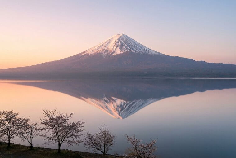
Here's what makes it extraordinary: the photographer returned to this exact spot for 11 consecutive mornings, waiting for zero-wind conditions to deliver a glass-smooth lake surface. Patience like that separates a snapshot from a masterpiece. But the next volcano on this list? Nobody had time to wait at all.
Mount Vesuvius Looming Over Naples at Sunset
Everyone knows Mount Vesuvius destroyed Pompeii in 79 AD. What's harder to grasp is that three million people still live directly beneath it. This golden-hour photograph makes that reality visceral — Naples sprawls across the foreground in warm terracotta and laundry lines while Vesuvius rises behind it all, backlit by a sunset that turns the sky molten orange. It looks almost peaceful. Almost. The volcano is overdue for a major eruption, and evacuation plans for the dense urban zone remain a logistical nightmare.
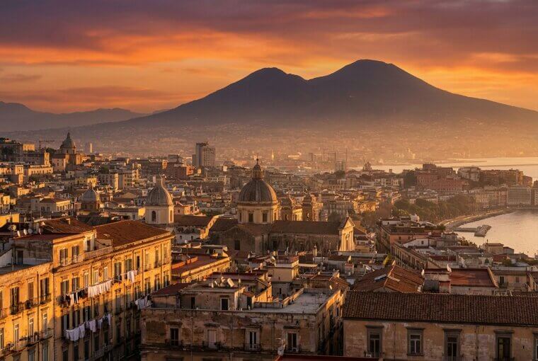
That tension between beauty and catastrophe is what makes this image impossible to scroll past. You're looking at everyday life unfolding in a kill zone, and it's gorgeous. The next shot takes that danger and turns it literal — with lava meeting ocean in real time.
Kilauea's Lava Pouring Into the Pacific
Kilauea's lava entering the Pacific Ocean is one of Hawaii's most photographed natural events — molten rock meeting seawater in explosive bursts of steam that tower hundreds of feet into the air. The orange ribbons pouring over black sea cliffs while the ocean boils white beneath them create a color palette that looks digitally enhanced but isn't. This particular shot captures that collision from dangerously close range, standing on what's called a lava bench — a fragile shelf of newly formed land hanging over the water.
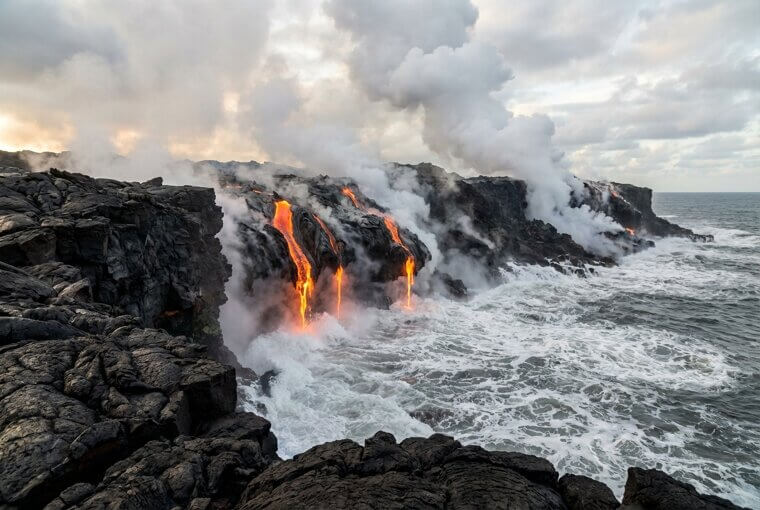
The bench the photographer stood on collapsed into the ocean just hours later, taking a chunk of coastline with it. No warning, no sound — just gone. Sometimes the most iconic shots exist because someone survived taking them. The next image on this list tested that truth even further.
Mount St. Helens' Explosive 1980 Eruption Sequence
Everyone's seen the footage of Mount St. Helens erupting on May 18, 1980. But Gary Rosenquist's rapid-fire photograph sequence captures something no video could — the exact second the volcano's entire north face slid away in the largest landslide in recorded history. One frame shows an intact mountain. The next shows it collapsing. The speed of transformation is almost impossible to process. Rosenquist was camped eleven miles away when the eruption began, shooting frame after frame as a lateral blast traveling 670 miles per hour exploded outward.
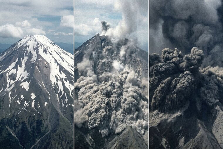
He threw his camera in the car and floored it, barely outrunning the ash cloud that killed 57 people that morning. Those photos survived because he did. The next image on this list pairs volcanic fury with something you'd never expect overhead.
Iceland's Eyjafjallajökull Piercing the Aurora
You wouldn't think two of nature's rarest light shows could appear in the same photograph, but during Iceland's Eyjafjallajökull eruption in 2010, that's exactly what happened. While the ash cloud was busy canceling over 100,000 flights and stranding millions of passengers across Europe, a photographer on the ground captured something extraordinary — jagged bolts of volcanic lightning crackling inside the eruption plume while the Northern Lights rippled in green and violet across the sky behind it.
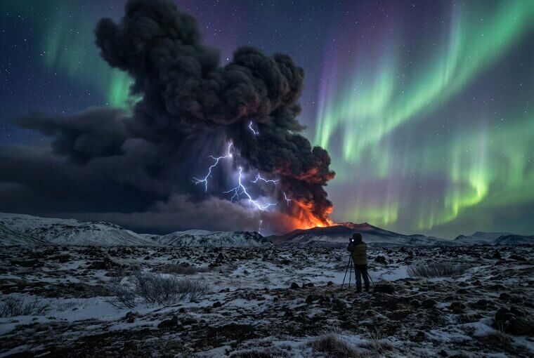
The collision of colors — electric white, ash gray, and aurora green — looks like two different photographs stitched together. It's one exposure. One moment where Earth's geology and the sun's charged particles decided to perform simultaneously. Speaking of otherworldly night skies over volcanoes, wait until you see what Sicily's Mount Etna delivered.
Mount Etna's Lava Fountain Against the Stars
Marco Restivo isn't just a photographer — he's a volcanologist who reads seismic data the way musicians read sheet music. When Mount Etna enters a paroxysmal phase, sending lava fountains over 3,000 feet into the Sicilian sky, Restivo already knows where to stand. He calculates safe distances using eruption models, then sets up long exposures timed to capture both the incandescent fountain and the Milky Way rotating overhead. The result is this image — molten orange arcing against a sky packed with stars, two kinds of fire separated by incomprehensible distance.
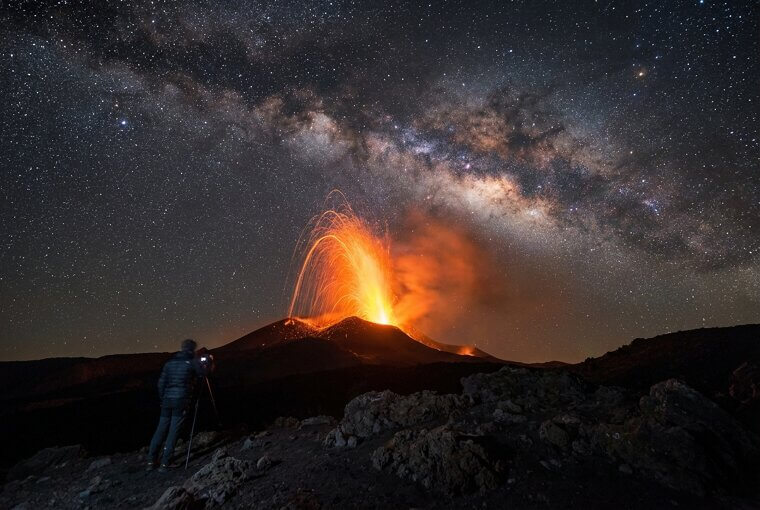
What most people don't realize is the timing window for this shot is sometimes under ten minutes. Seismic tremor patterns shift, wind redirects tephra, and the fountain intensity fluctuates wildly. Restivo nailed it in three frames. The next photo takes us somewhere flames burn an impossible color.
Kawah Ijen's Unearthly Blue Flames
Those flames aren't lava. At Indonesia's Kawah Ijen volcano, sulfuric gases ignite upon contact with air, producing rivers of electric-blue fire that cascade down the crater walls like something from a science fiction film. The phenomenon is only visible at night, and the first time most people see photos, they assume heavy digital manipulation. It's pure chemistry — sulfur combusting at temperatures exceeding 1,000°F, painting the darkness in neon blue. But look closer at the image. Those silhouettes moving through the toxic haze aren't scientists.
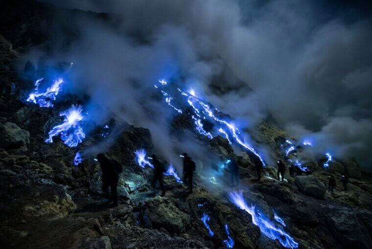
They're miners. Men carrying baskets loaded with up to 180 pounds of raw sulfur on bamboo poles, earning roughly $13 a day while breathing fumes that destroy their lungs. The blue flames become beautiful and unbearable simultaneously. The next shot shows a different kind of terror — a volcano that gave zero warning.
Calbuco's Mushroom Cloud Over Chile
When Chile's Calbuco volcano exploded in April 2015 after 43 years of silence, nobody had warning. No elevated seismic alerts, no gradual escalation — just a sudden mushroom cloud towering 50,000 feet over the lakeside town of Puerto Varas. Amateur photographers scrambled onto balconies and rooftops, capturing images so apocalyptic they were initially mistaken for nuclear test footage. The eruption column, backlit by sunset, became one of the most shared volcano photos of the decade.
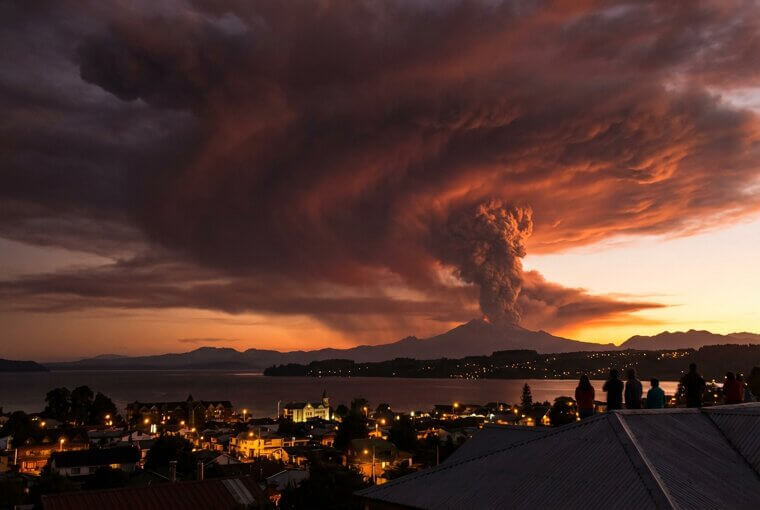
Here's what you can do today: fly into Puerto Montt, drive thirty minutes to Puerto Varas, and book a guided trek up Calbuco's lower flanks. The scarred landscape — stripped forests, ash-buried valleys, fresh erosion channels — tells the story those photos only hinted at. Next up, a volcano whose lava looks like a photo negative.
Ol Doinyo Lengai's Jet-Black Lava Flows
Forget everything you think you know about lava. Ol Doinyo Lengai in Tanzania — the Maasai "Mountain of God" — erupts natrocarbonatite lava that flows jet-black and barely reaches 950°F, roughly half the temperature of typical basaltic lava. It's so comparatively cool that researchers have accidentally stepped in it and walked away. Within hours of hitting air, the black lava reacts with moisture and turns ghostly white, meaning the entire mountain looks like a photo negative of itself.
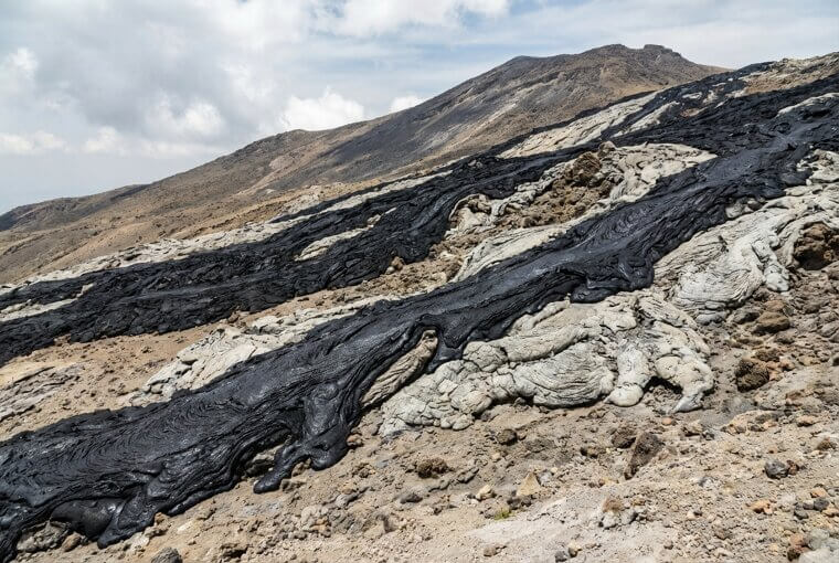
Photographers race against time to capture the black flows before they transform. The images are so strange that editors routinely reject them as digitally inverted. They're completely real. The next shot takes us to Japan, where a farmer's quiet routine tells a story more unsettling than any eruption.
Sakurajima Erupting Behind a Farmer's Field
Sakurajima erupts over 500 times a year. Five hundred. And in this extraordinary photograph, a farmer kneels in his radish field, calmly pulling daikon from volcanic soil while an ash plume billows thousands of feet into the sky directly behind him. He isn't running. He isn't even looking up. For the 600,000 residents of nearby Kagoshima City, this is Tuesday. Schools practice ash-fall drills the way American kids practice fire drills. Cars come equipped with special wipers to clear volcanic grit from windshields.
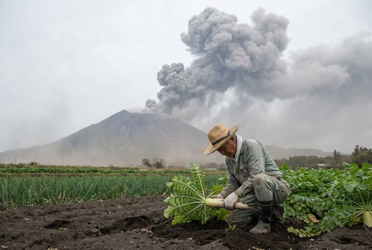
The photo is unsettling precisely because of its calm. It forces you to ask: what level of danger would you learn to ignore if it happened every single day? Sometimes the most powerful volcano image isn't about the eruption — it's about who doesn't flinch. Speaking of unflinching, the next photo was taken close enough to touch the lava.
Fagradalsfjall's Gentle Eruption at Arm's Length
Fagradalsfjall's 2021 eruption in Iceland was basically a volcano you could walk up to and photograph like a portrait session. The fissure eruption on the Reykjanes Peninsula produced slow, lazy lava flows so approachable that visitors literally roasted hot dogs and marshmallows over molten rock. Photographers crouched within feet of glowing magma rivers, capturing intimate close-ups showing every bubble, fold, and texture — images that feel impossible yet required nothing more than sturdy boots and a willingness to hike.
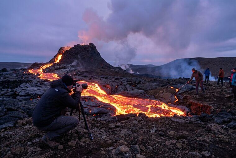
The Reykjanes Peninsula remains volcanically active, with eruptions recurring in 2022, 2023, and 2024. Local operators run guided tours to recent eruption sites from Reykjavík, just a 45-minute drive away. You don't need expedition gear or a death wish — just a plane ticket. But the next photo? That one required evacuating for your life.
Volcanic Lightning Inside Taal's 2020 Eruption
Here's something scientists still can't fully explain. When Taal Volcano in the Philippines erupted in January 2020, its massive ash column generated its own lightning storm — bolts of electricity crackling through volcanic debris in a phenomenon called a "dirty thunderstorm." The leading theory involves ash particles colliding violently, stripping electrons and building enormous electrical charges, but researchers are still piecing together the full mechanism.
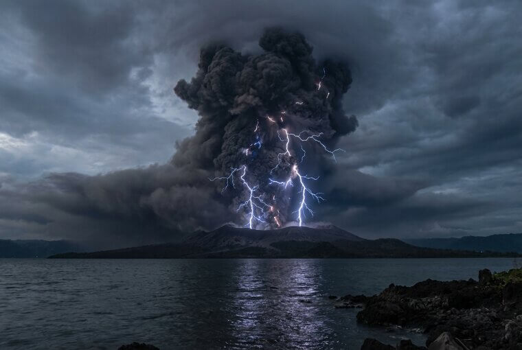
What makes these images extraordinary is who took them. Not professional photographers — evacuating residents, shooting through car windows and from rooftops on their phones, capturing something scientists travel the world to study. The next image required traveling to a remote French island most people have never heard of.
Piton de la Fournaise's River of Fire
Piton de la Fournaise on Réunion Island erupts so frequently — roughly every eight months — that French volcanologists have turned it into one of the most heavily monitored volcanoes on Earth. The Observatoire Volcanologique du Piton de la Fournaise has installed networks of cameras, seismometers, and GPS stations across its flanks, capturing something you won't see anywhere else: rivers of incandescent lava cutting through dense tropical rainforest. The contrast is surreal — ribbons of orange fire flowing between emerald green vegetation, steam rising where two worlds collide.
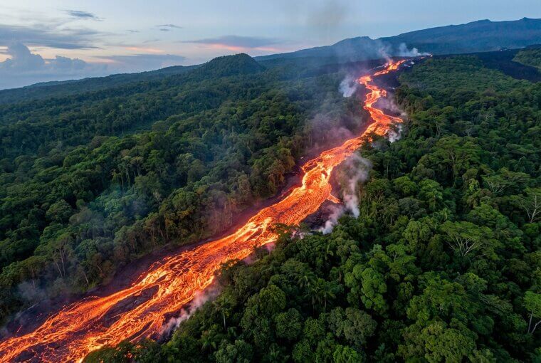
Insiders know this volcano offers the rare combination of extreme photogenic eruptions with relatively low danger, since lava flows away from populated areas toward the sea. It's a volcanologist's dream laboratory. But the next volcano floats inside a sea of mist like something from a fantasy novel.
Mount Bromo's Crater in a Sea of Mist
Mount Bromo in East Java is one of the most photographable volcanoes on Earth — and you don't need any special skills to prove it. The trick is committing to a 2 AM jeep ride from the nearby town of Cemoro Lawang to the Penanjakan viewpoint, arriving before dawn. As the sun rises, Bromo's smoking crater emerges from a vast caldera filled with rolling fog, making the volcano appear to levitate above the clouds. The scene looks heavily edited. It's not.
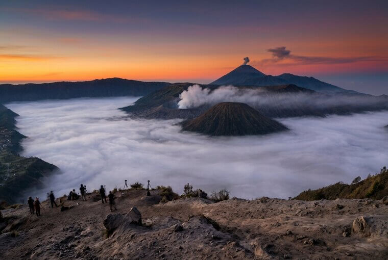
Any decent smartphone will nail this shot — the natural contrast between golden light, white mist, and the dark volcanic cone does the heavy work for you. Thousands of travelers capture this exact image every year, and it never gets old. But the next volcano on our list hasn't needed a photographer's patience — it's been putting on a show every fifteen minutes for two thousand years.
Stromboli's Nightly Fireworks Show
Stromboli might be the most photographer-friendly volcano on the planet. This tiny Italian island off Sicily's coast has been erupting nearly continuously for over 2,000 years, launching glowing lava bombs into the darkness every 15 to 20 minutes like clockwork. Guided sunset hikes depart daily, timing your summit arrival for nightfall — when the show really begins. The three-hour trek costs around €30 with a certified guide, and you'll want a tripod for long exposures that turn individual bursts into cascading arcs of orange light.
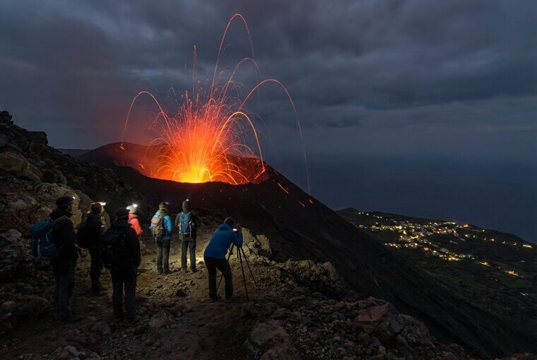
The eruptions are close enough to feel the heat on your face, yet guides know exactly where the safe viewing zones are. It's the rare volcanic experience you can actually plan around. The next destination, however, requires camels, days of walking, and surviving the hottest inhabited place on Earth.
Erta Ale's Permanent Lava Lake in Ethiopia
Erta Ale sits in Ethiopia's Danakil Depression, where daytime temperatures exceed 120°F and the landscape looks like Mars. Only about five persistent lava lakes exist on Earth at any given time, and Erta Ale's has been churning almost continuously since the 1960s. Reaching it requires a multi-day camel trek across salt flats with armed Afar guides — there's no road, no infrastructure, and no rescue helicopter coming if things go wrong.
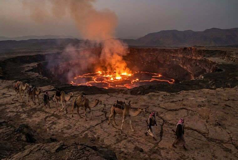
Photographers who make the journey peer over the crater rim at night into a churning cauldron of molten basalt, its surface cracking and folding like living skin. The images look like windows into the planet's mantle. But the next lava lake on our list doesn't just glow — it threatens two million people sleeping beneath it.
Mount Sinabung's Pyroclastic Flow Caught Mid-Collapse
This is the photo that makes your stomach drop. In 2014, a local Sumatran photographer aimed his camera at Mount Sinabung just as a massive pyroclastic flow — a superheated avalanche of gas, ash, and rock reaching 1,300°F — detached from the summit and began racing downhill at up to 450 mph. The image freezes something no human can outrun: a churning gray wall swallowing everything in its path, palm trees still standing in the foreground like they have seconds left.
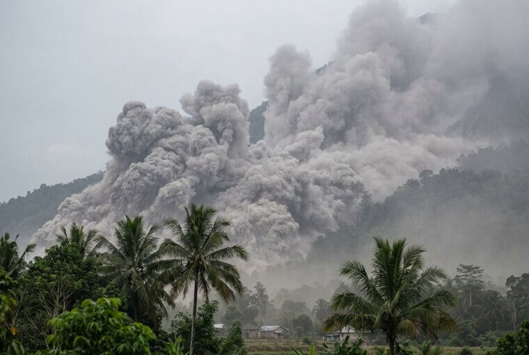
That eruption killed 16 people in nearby villages. Sinabung had been dormant for 400 years before reawakening in 2010, and pyroclastic flows remain its most lethal threat — unpredictable, unsurvivable, and terrifyingly photogenic. But the next volcano doesn't just threaten a village. It looms over a city of two million.
Nyiragongo's Lava Lake Glowing Over Goma
Nyiragongo's lava lake is the largest on Earth — a churning pool of molten rock half a mile wide perched above the Congolese city of Goma. Nighttime photographs capture something almost biblical: an eerie crimson glow bleeding upward into the clouds, bathing two million sleeping residents in red light. This isn't abstract danger. In 2002, Nyiragongo's lava flows reached 60 mph — the fastest ever recorded — racing through city streets and displacing 400,000 people overnight.
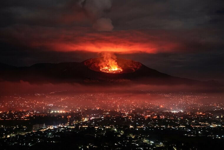
The volcano remains active today, with no reliable early warning system protecting the population below. It's a photograph that doubles as a humanitarian crisis in slow motion. Up next, a volcano that pairs its drama with hot springs and pure relaxation.
Arenal Reflected in Hot Springs at Twilight
Here's your permission to book that Costa Rica trip. Arenal Volcano rises in a near-perfect cone above Tabacón Hot Springs, where geothermally heated water cascades through lush tropical gardens into soaking pools. The twilight shot — Arenal's silhouette reflected in steaming water surrounded by jungle — is genuinely achievable for anyone with a smartphone and a resort reservation. The volcano has been dormant since 2010, which means no eruption risk, just pure scenery.
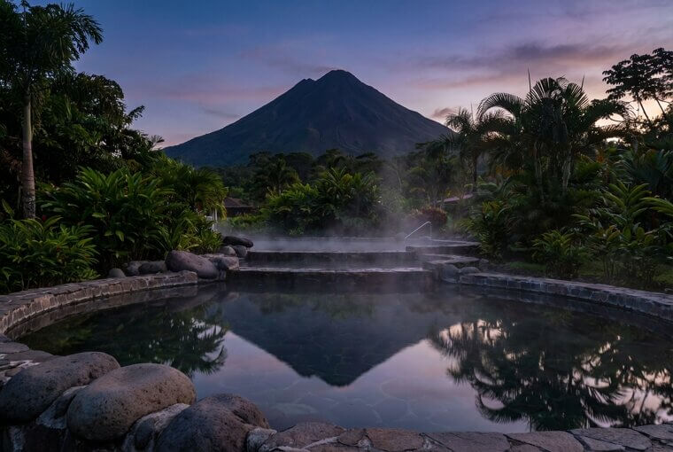
Tabacón's pools range from 77°F to 122°F, and the best photo spot is the upper river pool where the volcano fills the frame above the steam. Pair it with La Fortuna's hanging bridges walk for aerial rainforest shots. But our next image? No spa required — just the International Space Station.
Sarychev Peak's Eruption Seen From Space
Sarychev Peak didn't need a photographer on the ground. In June 2009, astronauts aboard the International Space Station looked down from 250 miles up and witnessed something extraordinary — a violent eruption on Russia's remote Kuril Islands punching a clean hole straight through the cloud deck. The resulting image is almost too perfect: a brown ash plume mushrooming upward, surrounded by a pristine white ring where the shockwave pushed clouds away, with the Pacific Ocean gleaming below.
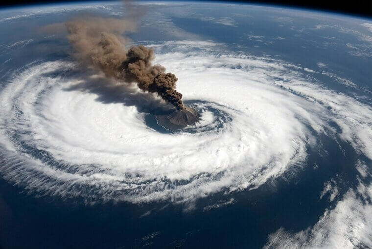
It became NASA's most shared volcano photograph ever, proving that sometimes the most dramatic human perspective requires leaving the planet entirely. No tripod, no hiking, no danger — just orbital timing and a window seat at 17,000 mph. Speaking of extraordinary vantage points, the next shot required a different kind of altitude entirely.
Klyuchevskoy's Shadow Cast Across the Clouds
Klyuchevskoy stands 15,584 feet tall — Russia's highest active volcano — and at sunrise, it casts a perfectly triangular shadow across the entire cloud deck below. Expedition photographers on Kamchatka's remote peninsula know this phenomenon requires a precise altitude sweet spot: too low and you're inside the clouds, too high and the geometry flattens. The shadow stretches for dozens of miles, a dark pyramid stamped across white vapor, and it shifts visibly as the sun climbs. Veteran volcano photographer Denis Budkov spent three expeditions before finally reaching the right ridgeline at the right moment.
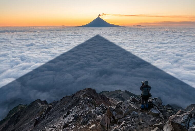
He called it the single most surreal image of his career — a volcano projecting its own ghost across the sky. Most photographers never get the chance. But our next destination doesn't require any climbing at all, because it barely qualifies as a volcano in the traditional sense.
Dallol's Acid Pools Look Like Another Planet
Dallol in Ethiopia's Danakil Depression doesn't erupt with lava or ash. Instead, it seeps. Hydrothermal springs push boiling acid through mineral deposits, creating pools of electric yellow, toxic green, and burnt orange that look like someone spilled paint across an alien world. Every single photo from Dallol triggers the same reaction online: "This is obviously AI-generated." It's not. The colors come from sulfur, iron hydroxides, and salt formations interacting with superheated water in one of the most inhospitable places on Earth.
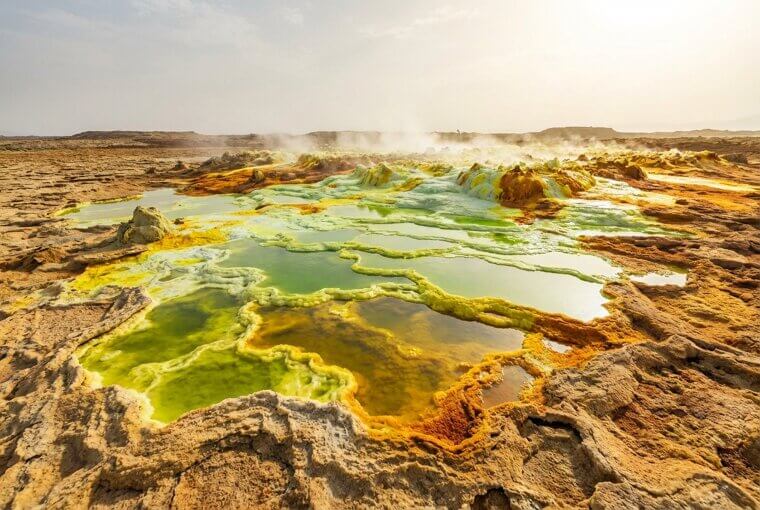
Air temperatures here regularly exceed 120°F, the pools hover around pH 0 — more acidic than battery acid — and there's no infrastructure for miles. The photographers who reach Dallol earn every pixel. And the next image? It was taken somewhere even more remote — the bottom of the world.
Mount Erebus Steaming in Antarctic Silence
Mount Erebus sits on Ross Island, Antarctica — a place so remote that reaching its 12,448-foot summit requires military transport, weeks of planning, and survival gear rated for conditions that can kill in minutes. Yet inside its crater, a persistent lava lake has been churning for decades, molten rock glowing at over 1,700°F while air temperatures plummet to negative 20. The contrast is almost incomprehensible: fire and ice coexisting in Earth's most extreme environment.
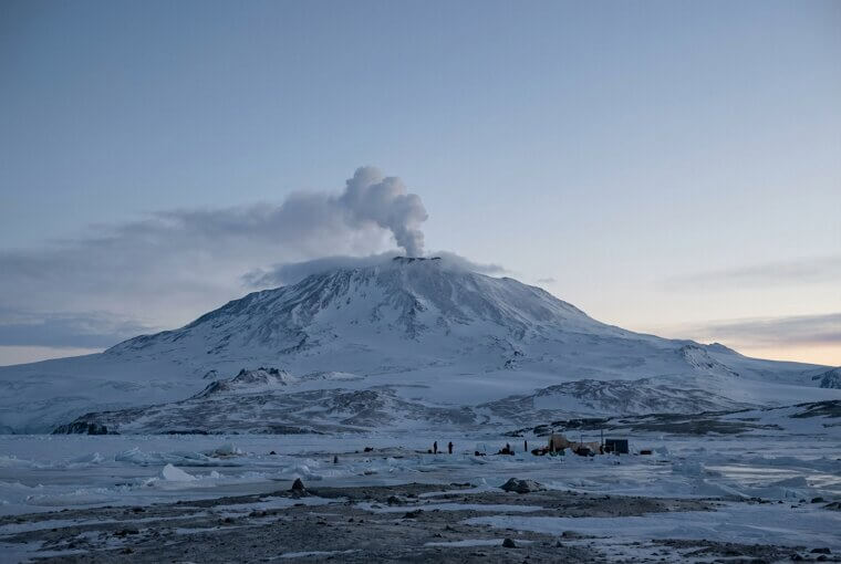
Fewer than a hundred people have ever stood on its rim and photographed what they saw. Each image — steam billowing into polar silence, magma pulsing beneath a frozen sky — represents one of the rarest perspectives in volcano photography. Next up, a volcano whose fury earned it a name that translates to pure terror.
Tungurahua's "Throat of Fire" at Full Fury
Tungurahua's Quechua name translates to "Throat of Fire," and during its ferocious 2014 eruption, it lived up to every syllable. Incandescent boulders streaked down all flanks simultaneously like comets racing toward the valley floor, while an ash column punched miles into the atmosphere. The photos from that night are staggering — every ridge lit orange, the sky choked with debris, and the entire mountain seemingly alive with destructive energy.
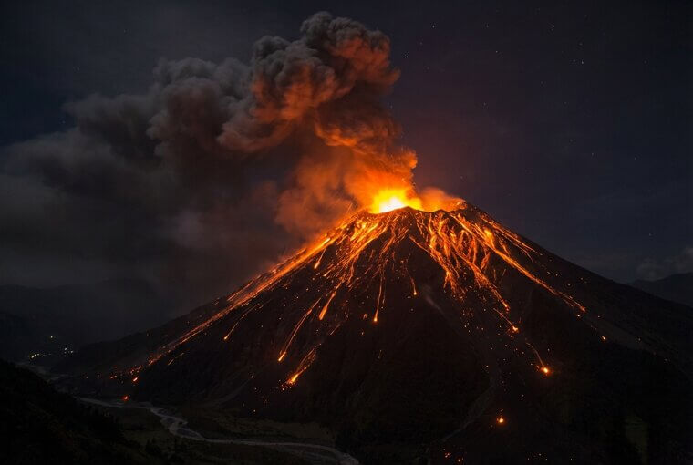
But here's what haunts you: the town of Baños sits just five miles from the crater. Evacuated multiple times, residents have always returned, choosing home over safety. That tension between beauty and catastrophe lives in every frame. Speaking of impossible geometry, wait until you see what makes our next volcano the most visually perfect on Earth.
Mayon's Near-Perfect Cone Wrapped in Lightning
Mayon Volcano in the Philippines has baffled geologists for decades. Its cone is so geometrically precise — with slopes maintaining a nearly constant angle from base to summit — that it's widely considered the most symmetrical stratovolcano on Earth. During its 2018 eruption, photographer Ciriaco Santiago III captured volcanic lightning crackling around that flawless silhouette, electricity arcing through ash particles in a display that turned perfect geometry into something almost supernatural.
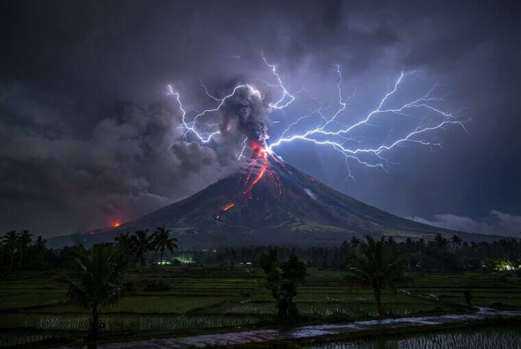
Here's what insiders know: Mayon's symmetry shouldn't exist. Most volcanoes develop irregular profiles from lopsided eruptions and sector collapses. Leading theories credit Mayon's consistent eruption frequency and uniform magma viscosity, but no consensus exists. It remains a beautiful anomaly. The next photo, however, captures the moment beauty became something far darker.
White Island's Crater Lake Moments Before Tragedy
On December 9, 2019, tourists stepped onto Whakaari/White Island and photographed a scene of alien beauty — a turquoise crater lake steaming against sulfur-yellow walls, the air thick with volcanic gas. They posed for selfies at the rim. They marveled at the otherworldly colors. Within minutes, the volcano erupted without warning. Twenty-two people died. Many of the recovered cameras and phones contained images taken moments before the blast — serene, beautiful, completely oblivious to what was coming.
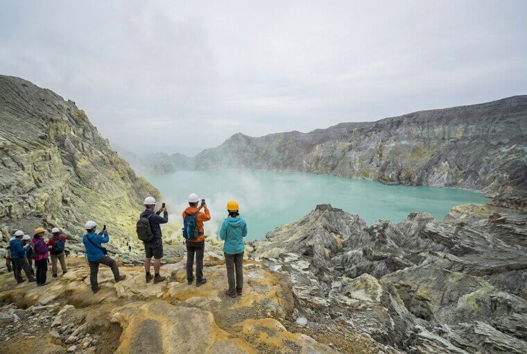
Those final photos are almost unbearable to view now, knowing what followed seconds later. They've since transformed how New Zealand regulates volcanic tourism entirely. But from destruction, something always emerges — as the next photo proves in the most literal way possible.
Krakatoa's Child Rising From the Sea
Anak Krakatau — "Child of Krakatoa" — is a volcano born from grief. When Krakatoa obliterated itself in 1883, it killed 36,000 people and left nothing but a drowned caldera. Then in 1927, fishermen watched in disbelief as a new island shouldered its way above the waves, rising from the exact wound its parent left behind. Photos of Anak Krakatau steaming against open ocean carry an emotional weight that transcends geology.
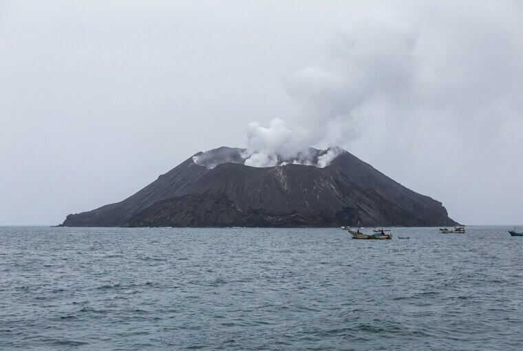
This is a child growing in its parent's grave. Every plume of ash, every fresh layer of rock, is the Earth quietly insisting that destruction is never the final word. It's devastation composing its own reply. And sometimes, rebirth happens somewhere even more unexpected — like a farmer's cornfield in rural Mexico.
Parícutin Growing in a Mexican Farmer's Cornfield
On February 20, 1943, Dionisio Pulido was working his cornfield in Michoacán, Mexico, when the ground cracked open and began hissing sulfurous smoke. Within a week, a volcano stood five stories tall where his crops had been. Within a year, it had buried two entire villages. The black-and-white photographs from that era hit differently than any color eruption shot ever could — especially the images of the church of San Juan Parangaricutiro, its stone steeple rising defiantly above a frozen sea of lava, the only structure that refused to disappear completely.
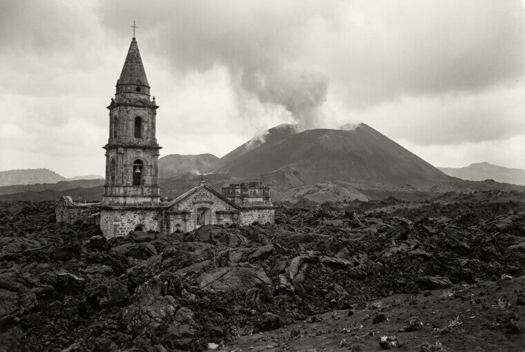
That half-swallowed church still stands today, a quiet monument to everything an ordinary family lost in an afternoon. Pulido's cornfield became a 1,391-foot mountain. But if Parícutin shows what nature can bury, the next photo reveals something even more moving — what it can heal.
Mount Pinatubo's Crater Lake Reborn in Turquoise
Mount Pinatubo killed nearly 850 people in 1991, ejected so much ash it cooled the entire planet by half a degree, and left a shattered crater where a mountain peak once stood. Then, quietly, rain fell. Year after year, water gathered in that ruined summit until something breathtaking emerged — a pristine turquoise lake cradled inside the wound, so still it mirrors clouds. Aerial photographs of Pinatubo's crater lake today look like Earth pressing a jewel into its own scar tissue.
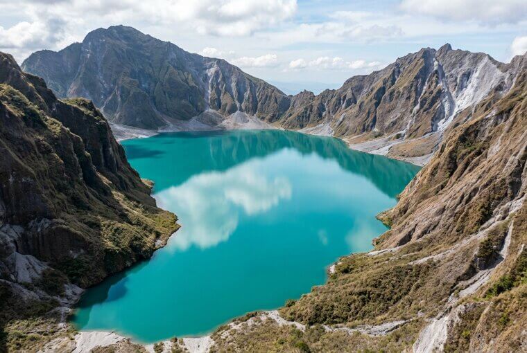
The indigenous Aeta people, displaced by the eruption that remade their homeland, now guide visitors up the mountain's slopes to witness the transformation firsthand. They walk you toward healing made visible. Our final photo takes us to where the planet isn't just healing — it's still actively being born.
Kīlauea's New Land Still Steaming With Creation
On Kīlauea's eastern flank, land that didn't exist before 2018 now stretches nearly a mile into the Pacific. Eight hundred acres of jet-black lava rock, still warm in places, still venting steam through cracks like the Earth is breathing. And already, impossibly, bright green ʻamaʻu ferns are unfurling from those cracks — life arriving before the ground has even finished cooling. In Hawaiian tradition, this is Pele's gift: new earth, raw and sacred, offered to the future.
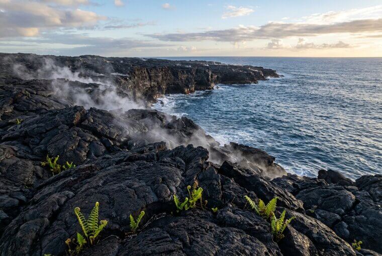
You can walk on it. Hawaiʻi Volcanoes National Park lets visitors stand on ground younger than most smartphones, feeling warmth rise through their shoes. Twenty-seven volcanoes. Twenty-seven reminders that our planet is still, beautifully, a work in progress.Disclaimer: This story is based on real events. However, some names, identifying details, timelines, and circumstances have been adjusted to protect the privacy of the individuals involved. The images in this article were created with AI and are illustrative only. They may include altered or fictionalized visual details for privacy and storytelling purposes