
You've looked out an airplane window and thought, "That can't be real." Turns out, our brains literally aren't built to process what the world looks like from above. We're going to show you images that will make you question everything — blood-red rivers, desert "paintings," and hidden shapes farmers never knew existed on their own land.
Earth Looks Strange From Above
You've felt it before — that moment on a flight when you glance out the window and the world below looks completely fake. Roads become thin scratches. Swimming pools turn into tiny blue gems. Entire cities shrink into circuit boards. Your brain quietly whispers that none of it looks real, even though you know it is. Here's why that feeling hits so hard: human eyes evolved to process the world from about five and a half feet off the ground.
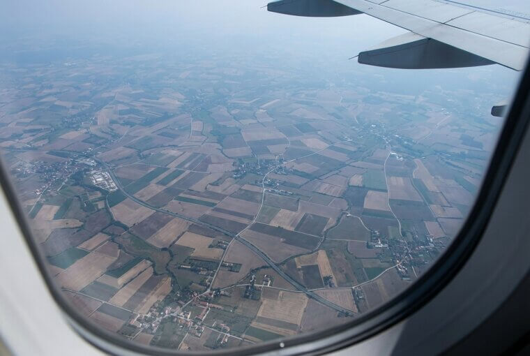
Everything above that? Our brains are essentially improvising. That disconnect between what we see and what we can process creates a strange, almost dreamlike sensation. The images ahead push that feeling further than you've ever experienced — starting with a scientific explanation that changes how you'll see every flight from now on.
Why Our Brains Misread Altitude
Here's the science behind that dreamlike feeling. For roughly six million years, our ancestors navigated the world at ground level. Our visual cortex became masterfully tuned to horizontal perspectives — judging distances across plains, spotting threats between trees. But viewing the earth from directly above? That's an evolutionary blind spot. Your brain has no ancient reference file for it, so it scrambles to match aerial patterns against things it does recognize: fabric textures, paint swirls, microscopic slides.
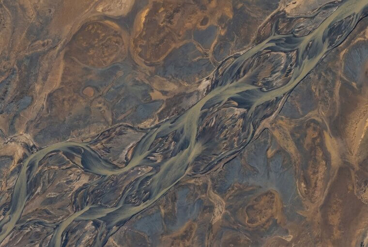
Even experienced pilots admit they occasionally do a double-take at landscapes they've flown over hundreds of times. If professionals get fooled, imagine what happens when farmland arranges itself into something nobody planned.
Farmland That Looks Like Patchwork Quilts
You've seen it from a window seat — that vast patchwork of green, gold, and brown squares stretching to the horizon like a handmade quilt draped over the earth. Most people assume farmers just carved the land into random shapes. But those patterns are surprisingly deliberate. The perfect green circles? Those come from center-pivot irrigation systems — quarter-mile-long arms that rotate around a fixed point, watering crops in massive rings. The contrasting color blocks happen because neighboring fields are planted with different crops or harvested on different schedules.
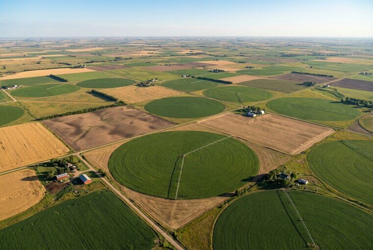
Grandma's quilt pattern was literally beneath you at 30,000 feet this whole time — geometry born from engineering and seasons, not artistry. Remember those green crop circles, though. They show up again later in this article, and the context will be far stranger than farming.
These Aren't Paintings, They're Deserts
Some of the most stunning aerial photographs of the Namib Desert have been mistakenly entered into abstract art competitions — and judges couldn't tell the difference. That's not an insult to art. It's a testament to what wind can do with a few million years and unlimited sand. From above, the Namib's sand seas form sweeping curves and layered ridges that look exactly like thick brushstrokes dragged across canvas. Burnt orange bleeds into deep shadow. Ridgelines create texture you'd swear came from a palette knife.
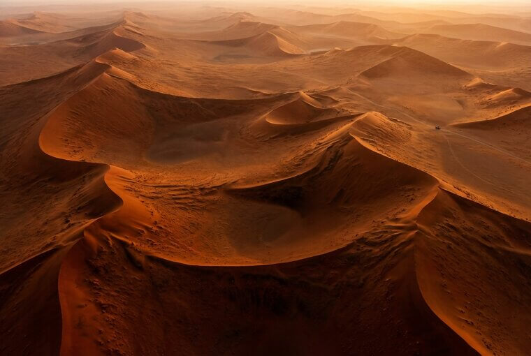
The Namib's dunes, some reaching nearly a thousand feet tall, cast shadows so sharp they resemble charcoal sketches. No human hand involved — just physics performing at a scale we can barely comprehend. But sand isn't the only natural material producing impossible colors from above.
The River That Runs Blood Red
Imagine looking down from a plane and seeing a river that looks like it's flowing with blood. That's Lake Natron in Tanzania — a vast, shallow lake that turns a shocking crimson red from above. No pollution, no dye, no trick photography. The color comes from salt-loving algae called haloarchaea that thrive in the lake's extreme alkalinity. Spain's Rio Tinto pulls off something similar, its waters stained deep red by iron-rich mineral deposits dissolving from ancient mines.
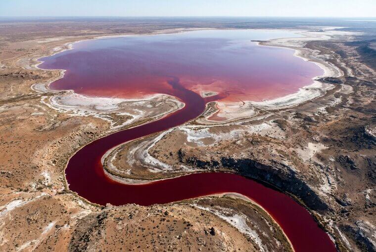
These waters are so vivid that first-time pilots have reportedly radioed in emergency reports, convinced they were witnessing ecological disasters. Earth doesn't need a filter — it makes its own impossible palette. And you can actually spot some of nature's wildest colors from a regular window seat, if you know where to look.
You Can Spot These From Your Window Seat
Next time you fly, you'll have three insider tricks that turn a boring window seat into a discovery mission. First, watch for salt evaporation ponds near any coastline — they appear as impossibly vivid rectangles of magenta, teal, and orange right next to ordinary water. Second, look for the seam where two cities' street grids collide at awkward angles — it's surprisingly visible and tells you exactly where one town's history ended and another's began.
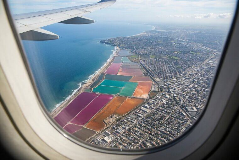
Third, scan any flat river valley for curved scars in the farmland — those are ancient meander paths where the river used to flow, still etched into the earth like ghostly signatures. You now see what most passengers miss entirely. And those neon salt ponds? They deserve their own section.
Google Earth Changed Everything Forever
Before 2005, the only people who saw Earth from above were pilots, astronauts, and military intelligence analysts. Then Google Earth launched, and overnight, billions of people gained access to perspectives that had been classified or simply unreachable. That alone was revolutionary. But what happened next changed history. Amateur researchers scanning satellite imagery discovered lost Egyptian pyramids buried under sand. Journalists documented illegal logging in the Amazon in real time. Investigators tracked secret prison sites.
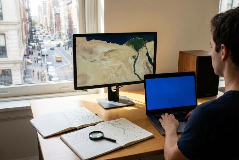
Entire civilizations hidden for centuries were suddenly visible to anyone with a laptop. Aerial imagery isn't just beautiful — it's become one of the most powerful accountability tools on the planet. And deep in the world's forests, it revealed something nobody can fully explain.
Forests With Perfect Mysterious Circles
Scattered across Namibia's grasslands are millions of perfectly circular bare patches, each one ringed by a border of taller grass. From above, they look like polka dots stamped onto the landscape by something impossibly precise. Scientists call them fairy circles, and here's what's genuinely wild — after decades of research, nobody can definitively explain them. Termite colonies eating roots from below? Underground gas seepage? Plants competing so fiercely for water they self-organize into geometric patterns? Each theory has evidence, and each has holes.
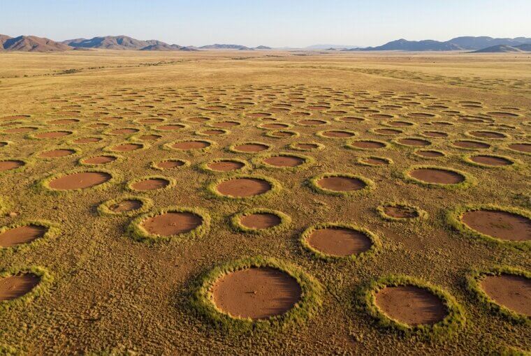
Then researchers found nearly identical circles in Australia's outback and parts of Western Australia, thousands of miles from Namibia. You can find them yourself on Google Earth right now — just search the NamibRand Nature Reserve. They're real, they're unexplained, and they're strangely beautiful. Sometimes, though, the strangest aerial colors aren't mysterious at all — they're industrial.
Salt Ponds Look Like Watercolor Palettes
Flying into San Francisco, you might glance down and see what looks like someone spilled a watercolor palette across the shoreline. Those neon rectangles are real — salt evaporation ponds where San Francisco Bay's water is slowly concentrated into commercial salt. Here's the stunning part: each pond's color depends on what's alive inside it. Low-salinity ponds host green algae. As salinity increases, brine shrimp turn the water orange. At extreme concentrations, halobacteria — ancient microorganisms thriving where almost nothing else can — paint entire ponds deep magenta.
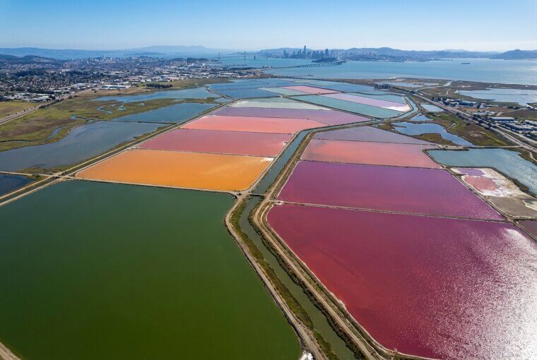
The Dead Sea has its own version, with ponds shifting from turquoise to rust depending on mineral content. Remember those salt ponds from our window seat tips? Now you know exactly why they glow. But farmers on the ground are hiding something even stranger above their heads.
Hidden Shapes Farmers Never Intended
Here's something insiders know: farmers walking their fields have zero idea what's visible above them. Satellite imagery has captured agricultural plots that accidentally form recognizable faces, letters, and geometric shapes through nothing more than planting patterns and harvest timing. No intention whatsoever — just coincidence at scale. But archaeologists discovered something far more useful. Buried Roman villas, medieval foundations, and ancient roads affect how crops grow directly above them. Stones underneath stunt root depth, creating subtle color variations invisible at ground level.
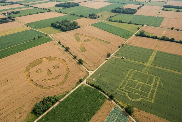
These "crop marks" have led to thousands of archaeological discoveries across Europe — entire lost settlements revealed because wheat grew slightly shorter in one strip of an ordinary field. The ground hides what only the sky can reveal. Speaking of hidden things — some of the most haunting aerial images aren't ancient at all.
Why Airplane Graveyards Look Haunting
In the Arizona desert outside Tucson, over 4,000 aircraft sit in perfect silent rows, wingtips nearly touching, stretching across 2,600 acres of sunbaked earth. From above, Davis-Monthan Air Force Base looks like a metallic cemetery — silver fuselages bleaching under relentless sun. These aren't replicas. They're real B-52 bombers, C-130 transports, F-16 fighters. Many flew missions in Vietnam, Desert Storm, Afghanistan. They carried crews who were terrified, brave, and young. Now the planes sit wingless and still, slowly surrendering to heat and time.
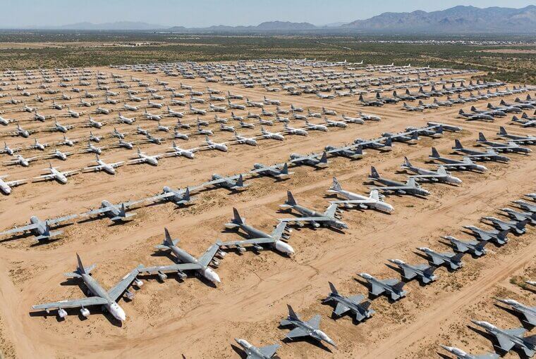
If you've ever watched a military flyover and felt something tighten in your chest, imagine seeing thousands of those same aircraft grounded forever in perfect formation. The desert preserves them because it's dry — but it also makes the image feel timeless, almost frozen. Some aerial views, though, reveal dangers much closer to home than you'd expect.
This Neighborhood Hides a Dark Secret
From the street, the subdivision looks perfectly normal — manicured lawns, cul-de-sacs, two-car garages. Pull up the aerial view, and your stomach drops. Entire neighborhoods sit squarely in FEMA-designated flood plains, houses built in neat rows right up to toxic Superfund sites, or developments carved into hillsides stripped of the vegetation that once prevented landslides. These aren't rare cases. An estimated 15 million American properties face substantial flood risk that isn't reflected in their price. Insurance adjusters and real estate investors check aerial imagery before committing a dollar — because the overhead view reveals what the curb appeal deliberately hides.
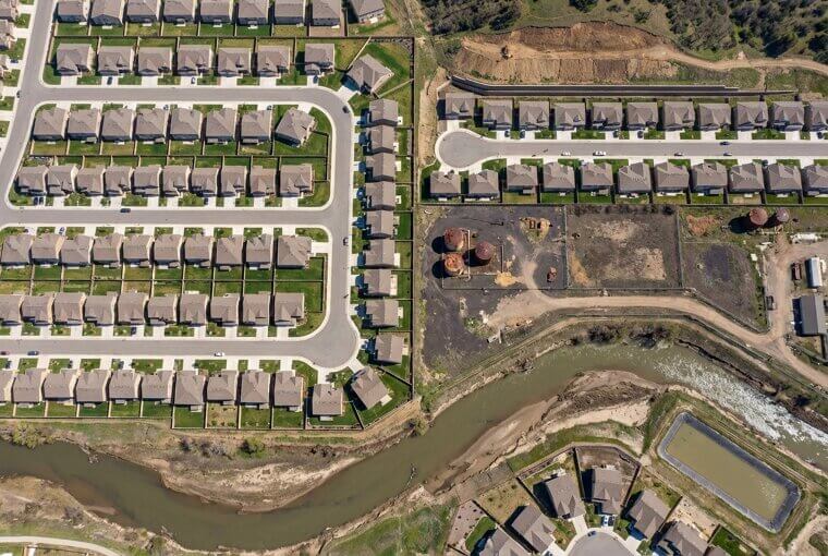
Have you ever looked at your own property from above? Your home's biggest vulnerability might be completely invisible from your front porch but obvious from a satellite. The good news: you can check right now — and the next section shows you exactly how.
How to Explore Earth From Your Couch
You don't need a plane or a drone — three free tools let you explore Earth's strangest sights right now. First, open Google Earth and click "Voyager" in the left menu. You'll find curated aerial tours of volcanoes, coral reefs, and hidden landscapes guided by National Geographic experts. Second, visit NASA Worldview — it streams real-time satellite imagery updated every few hours, showing storms, dust clouds, and wildfires as they happen. Third, Zoom Earth lets you track extreme weather live with stunning detail.
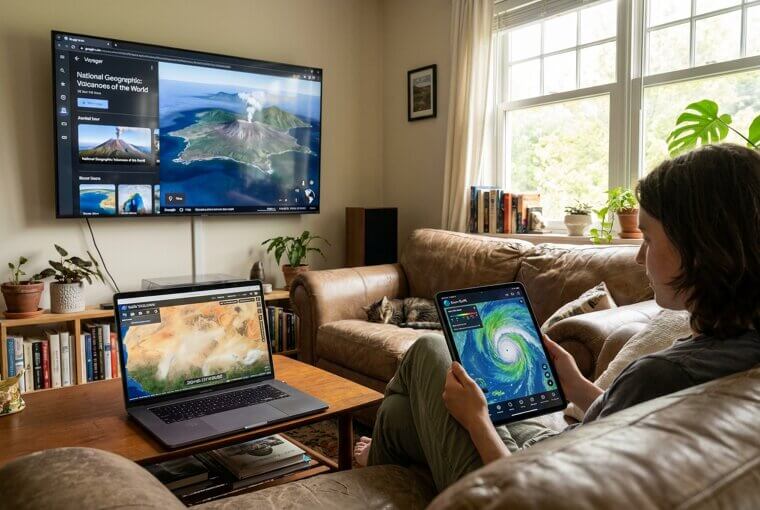
Want your jaw to drop? Type "Richat Structure, Mauritania" into Google Earth. You'll find a 30-mile-wide bullseye in the desert that looks impossibly artificial. We'll revisit that mystery later — but first, did you know there are entire mountain ranges most people have never heard of?
The Ocean Floor Has Mountain Ranges
The longest mountain range on Earth isn't the Andes or the Himalayas — it's underwater. The Mid-Atlantic Ridge stretches over 10,000 miles along the ocean floor, a massive volcanic spine that most people will never see with their own eyes. Satellite-derived bathymetry has mapped this hidden world, revealing trenches deeper than Everest is tall, seamounts rivaling the Rockies, and volcanic chains that dwarf anything on dry land.
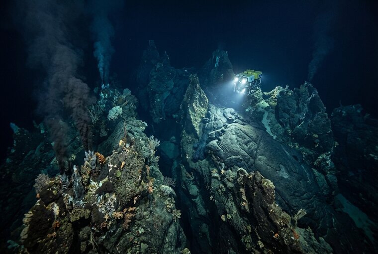
We'd been ignoring 70% of our planet's surface simply because it was covered by water. Aerial and satellite technology finally pulled back that curtain, proving Earth's most dramatic landscapes were always hiding beneath the waves. And speaking of hidden drama — some places above water look like they belong on another planet entirely.
Volcanic Hot Springs Look Like Alien Worlds
Grand Prismatic Spring in Yellowstone doesn't look like anything on this planet. From above, it's a massive eye of deep electric blue surrounded by concentric rings of emerald, gold, and burnt orange — colors so vivid they seem digitally enhanced. They're not. Those rings are colonies of heat-loving bacteria called thermophiles, each species thriving at a specific temperature, painting the landscape as precisely as any artist could.
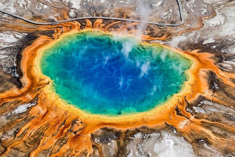
Ethiopia's Dallol volcano region pushes this even further — sulfur yellow pools, acid-green formations, and rust-red mineral deposits create scenery NASA literally uses to study what alien worlds might look like. Remember those blood-red rivers from earlier? Earth doesn't need filters. But not everything captured from above is so serious.
Satellites Caught People Doing This
In 2005, artists stitched together a 200-foot-long bright pink knitted bunny and draped it across an Italian hillside in Artesina. It was visible on Google Earth for years, slowly decomposing into the mountain like the world's strangest picnic blanket. Farmers have carved corn mazes into portraits of Dolly Parton and Abraham Lincoln — masterpieces visible only from above, completely invisible to anyone walking through them. One Australian man became briefly internet-famous when a Google satellite captured him sunbathing on his roof in a position he probably wouldn't have chosen for a global audience.
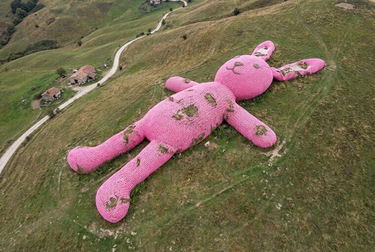
Have you ever wondered what a satellite might catch you doing? The truth is, these cameras are capturing far more than funny moments — they're also revealing things hidden underwater for centuries, including ships no one knew were there.
Shipwrecks Visible Only From the Sky
Maritime archaeologists now make their biggest discoveries without getting wet. Satellite imagery is their primary tool, revealing shallow-water shipwrecks that are completely invisible from shore. The SS Jassim, a cargo ferry that sank in the Red Sea in 2003, appears on Google Earth as a ghostly shadow stretching 81 meters across turquoise waters. In the Pacific, WWII warships and Japanese merchant vessels emerge from the blue when clear water, low tide, and the right sun angle align perfectly.
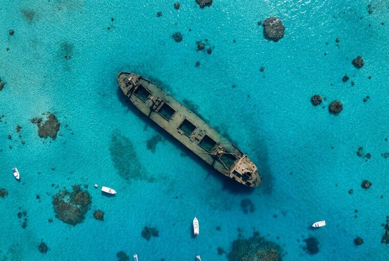
Some wrecks are centuries old — wooden trading vessels whose outlines appear as dark stains against sandy bottoms, visible only from directly above. You can find many of these yourself on Google Earth by searching known coordinates that wreck hunters share online. But aerial imagery isn't just useful for finding lost ships — it might help you protect something much closer to home.
Check Your Own Roof Right Now
Here's something you can do right now: open Google Earth on your phone, type in your home address, and zoom in. You're looking at the same view insurance adjusters use to evaluate your property before they ever visit. Check for missing shingles, pooling water stains, or trees with branches hanging dangerously over your roofline. Then search your county's GIS portal — most are free — and pull up your property lines. Some homeowners have discovered neighbors' fences encroaching several feet onto their land.
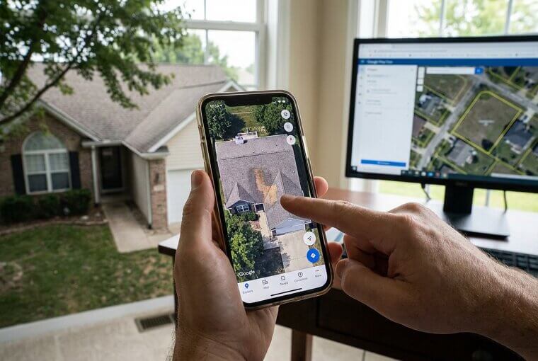
Others found their lot was actually bigger than their deed description suggested, adding real value they never knew existed. Drainage patterns, easements, grading issues — it's all visible from above. This ten-minute exercise could save you thousands. But zooming out further reveals something far more uncomfortable about where we all live.
Cities at Night Reveal Shocking Inequality
When NASA's "Black Marble" satellite captures cities at night, wealth inequality becomes impossible to ignore. In Mumbai, glittering high-rises blaze with light while adjacent slums dissolve into darkness — millions of people living in the shadows, literally. Detroit's divide is equally stark: some neighborhoods glow while others, abandoned by infrastructure investment, sit in near-total blackout. These aren't subtle differences. The light boundaries are razor-sharp, sometimes splitting a single street.
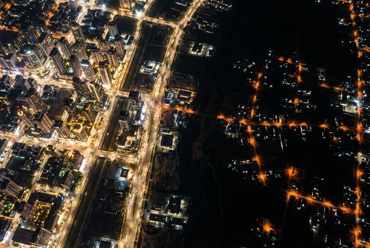
Researchers now use nighttime luminosity data to track poverty more accurately than census surveys in developing nations. The brightness of your neighborhood directly correlates with income, healthcare access, and life expectancy. It's all visible from orbit — a truth that ancient civilizations unknowingly left written in the landscape too.
Ancient Civilizations Left Visible Marks
Remember those crop marks from Section 10 — where buried ruins change how plants grow above them? Archaeologists have turned that principle into a science that's rewriting history. Satellite imagery revealed that Angkor Wat wasn't just a temple but the center of a sprawling water management system supporting nearly a million people. In England, Roman roads invisible for centuries reappear as faint crop shadows during dry summers, their buried foundations pulling moisture from the soil above.
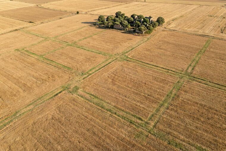
Peru's Nazca Lines — enormous geoglyphs spanning miles — remained completely unknown until pilots flew over them in the 1930s. Today, satellites have discovered over a thousand ancient structures that no one on the ground ever noticed. But not every stunning aerial image you've seen online is actually real.
This Image Fooled Millions of People
In 2023, a viral aerial photo of a "heart-shaped island" was shared over two million times on Facebook before anyone checked — it was AI-generated. It never existed. Fake aerial images are flooding social media, and they're getting harder to spot. Before you share that jaw-dropping photo, look for these red flags: shadows pointing in different directions, unnaturally perfect symmetry, and repeating textures where clouds or waves look copy-pasted. Run a reverse image search by holding down on the photo and selecting "Search Google for this image."
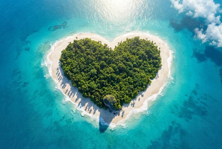
If it only appears on random blogs with no photographer credited, it's almost certainly fake. You deserve to be amazed by real wonders — and now you have the tools to tell the difference. Speaking of real wonders, there's a surprisingly fun way to test those skills right now.
Try This Five-Minute Google Earth Game
Open Google Earth on your phone or computer, tap the dice icon labeled "I'm Feeling Lucky," and you'll land somewhere random on the planet. Now play detective. Grid-pattern roads usually mean North America or Australia. Dense green canopy with winding brown rivers? Likely the Amazon. Turquoise coastal water suggests coral reefs — probably the tropics. Circular crop fields point to the Middle East or American plains. Red soil narrows it to Africa or the Australian outback.
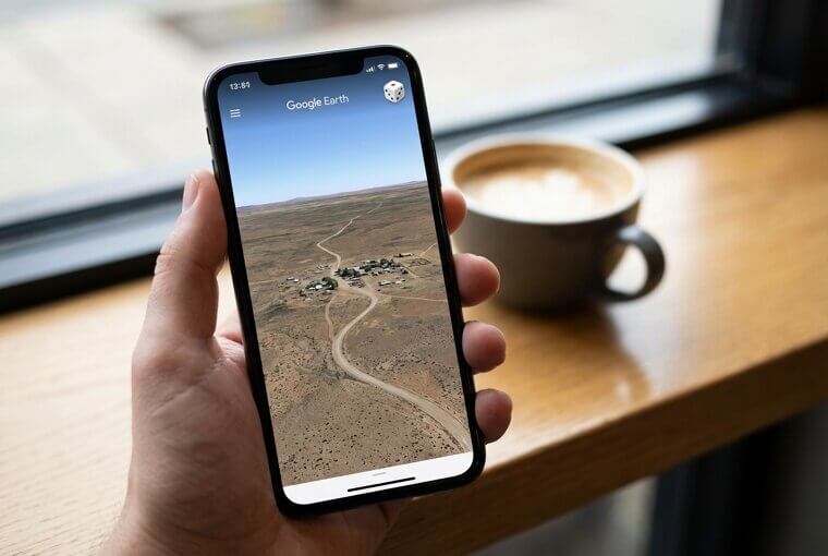
Give yourself five minutes and see how close you can guess. It's genuinely addictive — some grandparents play this over FaceTime with grandkids, taking turns dropping each other into mystery locations. It sharpens your brain while shrinking the world. But some places Google Earth reveals aren't fun at all — they're heartbreaking.
Glaciers Are Vanishing in Real Time
Alaska's Columbia Glacier has retreated over twelve miles since 1980 — visible in satellite time-lapses as a massive white tongue slowly dissolving into dark ocean. Greenland's ice sheet lost 4.7 trillion tons of ice between 2002 and 2023. In the Himalayas, glaciers feeding rivers that supply drinking water to two billion people are shrinking so fast that scientists compare consecutive satellite images with disbelief. You've heard the statistics. But watching a glacier disappear frame by frame in aerial imagery hits differently than any number ever could.
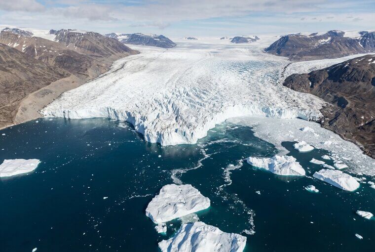
These before-and-after views are unflinching — white becomes gray, gray becomes bare rock, meltwater pools appear where ice stood for millennia. No argument, no agenda. Just the planet photographed across decades, telling its own story. And while satellites document what's disappearing, a much smaller flying machine is revealing things we never knew were there.
Drone Photography Revealed a Hidden World
Just fifteen years ago, the aerial images in this article required helicopters, planes, or military satellites. Today, a $300 consumer drone fits in a backpack and shoots footage that rivals professional cinematography. This quiet revolution has produced astonishing discoveries. Hobbyist pilots have found hidden waterfalls in dense forest canopies, forgotten 19th-century cemeteries overgrown beyond ground-level recognition, and whale feeding behaviors never previously documented.
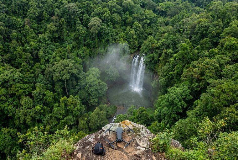
Much like Google Earth gave everyone satellite access, drones handed everyday people their own flying camera. Some of the most breathtaking aerial photos circulating online today were captured by retirees, teachers, and weekend enthusiasts — not National Geographic crews. But what happens when you turn that perspective toward a place you actually love?
Your Hometown Looks Different From Space
Go ahead — open Google Earth right now and type in the address where you grew up. Zoom in slowly. The streets will feel narrower than you remember. The yard that seemed enormous when you were ten might barely fit a car. The school playground, the corner store, the neighbor's oak tree — some will still be there. Some won't. That field where you caught fireflies might be a strip mall now. The creek where you skipped rocks might be buried under a subdivision.
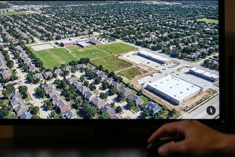
But look at the hills behind town. Look at the river bend. The landscape that held your childhood still holds its shape, even as everything built on top of it changed. There's something quietly powerful about that. And the strangest aerial image in this entire article? It's been waiting for you since Section 13.
The Strangest Image Has an Explanation
A perfect bullseye thirty miles wide, carved into the empty Mauritanian desert. If you followed the coordinates from Section 13, you've already seen the Richat Structure staring back at you from your screen like a giant geological eye. Astronauts originally used it as a landmark from orbit because nothing else in the Sahara looks remotely like it. For decades, scientists assumed a meteorite impact created those concentric rings. They were wrong.
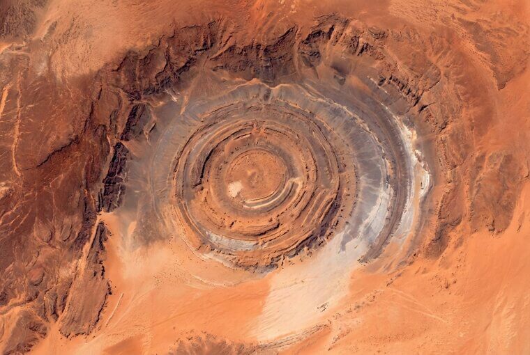
It's actually an ancient geological dome — layers of rock pushed upward hundreds of millions of years ago, then slowly eroded at different rates, exposing rings of harder and softer stone like peeling an onion from the top down. No aliens. No impact crater. Just deep time, doing patient, extraordinary work. And extraordinary work is also happening in real time, right above active disasters.
What Firefighters See From Helicopters
When wildfire smoke turns the sky opaque, commanders in helicopters aren't flying blind. Infrared aerial cameras cut through dense smoke to reveal exactly where flames are burning hottest, allowing incident teams to position firefighters with precision that ground-level visibility would never permit. During floods, real-time aerial mapping shows responders which roads are passable and which neighborhoods are already underwater — information that changes minute by minute. Search-and-rescue teams scanning rugged terrain from above can cover in twenty minutes what ground crews would need two days to search on foot.
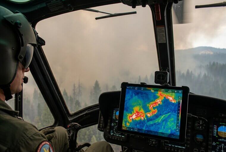
If you live in a fire-prone or flood-prone area, this technology is quietly protecting you right now. Emergency managers increasingly share these aerial maps publicly during disasters, so knowing where to find them matters. But after all this practical wonder, there's something even simpler worth doing with what you've learned today.
Share These Views With Someone You Love
Here's something worth trying today. Pick three images from this article — the blood-red lake, the neon salt ponds, the Eye of the Sahara — and text them to someone you care about with a simple question: "Can you guess what this is?" You'll be amazed at the conversations that follow. People light up when they're handed a mystery. If you have grandchildren, open Google Earth together on a tablet and let them pick any spot on the planet. Zoom in. Explore. Let them drag the little orange figure onto a street.

Kids who grow up exploring the world from above develop a sense of wonder that sticks. You're not just sharing images — you're sharing a way of seeing. And that shift in perspective? It might be the most meaningful thing this article has to offer.
We Forgot How to Look Up — and Down
Most of our days are spent staring at a world framed between our outstretched hands — a five-inch screen at arm's length. We look straight ahead. We forget there's a universe sprawling beneath our feet and arching over our heads. Aerial imagery gently shakes us awake to that forgotten dimension. But here's what resonates most deeply: perspective doesn't just change what you see geographically. It changes what you understand. Think about how different your hometown looked at twenty-five versus how it feels now.
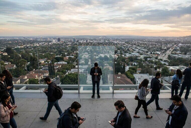
The streets didn't move. You did. The years gave you altitude — emotional altitude — and from up there, old heartbreaks look smaller, old kindnesses look enormous, and the whole messy landscape of your life finally reveals its pattern. That's not loss. That's the gift of elevation. And this article has one final thought worth carrying with you.
The Best View Is the Next One
Right now, somewhere over a coastline you've never visited, a satellite is capturing an image no human eye has ever seen. A drone is rising above a forest clearing, revealing a pattern that's existed for centuries without anyone knowing. New colors, new shapes, new mysteries — appearing every single day on a planet we thought we already knew.
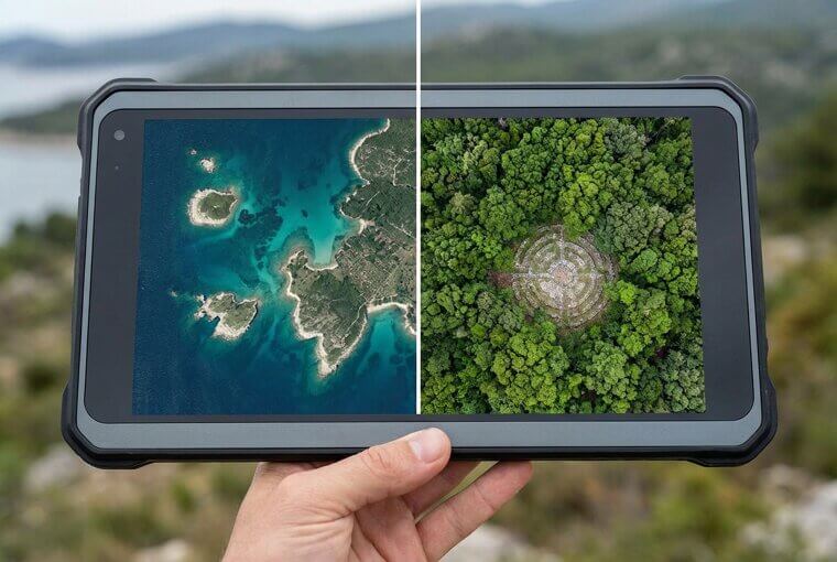
You don't need wings. You don't need a ticket. You just need the curiosity you've already proven you have by reading this far. The world is breathtaking from above, and now you know exactly how to find it. Go explore.Disclaimer: This story is based on real events. However, some names, identifying details, timelines, and circumstances have been adjusted to protect the privacy of the individuals involved. The images in this article were created with AI and are illustrative only. They may include altered or fictionalized visual details for privacy and storytelling purposes