
You've seen thousands of drone photos by now. Neighborhood shots, beach views, farmland from above — nothing special, right? But some of those ordinary-looking images are hiding details that stopped the internet cold. Alligators in pools. Ancient ruins under crops. A missing person found by a single shadow. Here's what most people scroll right past.
Drones See What We Can't
You've seen them buzzing over parks, hovering above neighborhood barbecues, and circling real estate open houses. Drones are everywhere now — your neighbor probably has one, and your nephew definitely does. Most of the photos they capture look exactly like what you'd expect: rooftops, backyards, stretches of coastline from a few hundred feet up. Pretty, but ordinary.
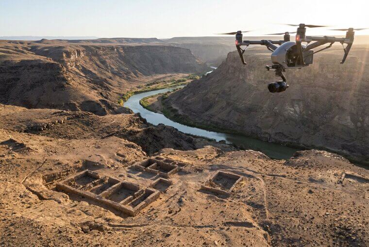
Except they're not. Because from that altitude, drones quietly capture details the human eye would never catch at ground level. What looks like a perfectly normal aerial snapshot can hide something jaw-dropping — if you know where to look.
The Backyard Pool That Went Viral
Picture a typical suburban neighborhood from above — cookie-cutter rooftops, tidy green lawns, a dozen backyard pools glowing that familiar chlorine blue. One widely shared drone photo captured exactly this scene somewhere in Florida. Completely unremarkable. Thousands scrolled past it. Then someone zoomed in on the pool in the lower right corner and noticed a dark shape stretched across the shallow end. It was an eight-foot alligator, fully submerged and perfectly still, just lounging like a paying guest.
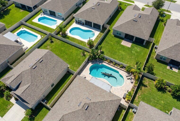
The homeowner had been swimming in that pool the day before and had absolutely no idea. The photo racked up millions of views — proof that even the most familiar places hide things we never think to look for. But here's what's fascinating: there's a scientific reason your brain missed it too.
Why Our Brains Miss These Details
Here's the thing — your brain evolved to process the world from about five and a half feet off the ground. That's the perspective humans have navigated for hundreds of thousands of years. We're experts at reading faces, judging distances across a room, and spotting movement at eye level. But 400 feet up? That's nobody's natural habitat. When you look at an aerial photo, your brain treats it almost like an abstract painting — it grabs the general pattern and moves on, glossing over anomalies it doesn't know how to categorize.
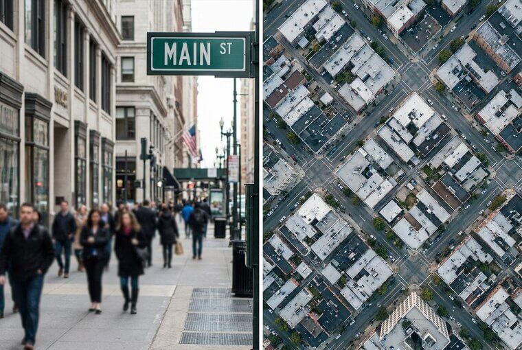
This is exactly why drone photos are full of things hiding in plain sight. Your brain isn't lazy — it's just untrained for this angle. The good news? You're about to fix that. Starting with a "deserted" beach that turned out to be anything but empty.
The "Empty" Beach That Wasn't
A photographer in Costa Rica launched his drone over what looked like a completely deserted stretch of coastline — just sand, rocks, and surf. Nothing moving. Nothing noteworthy. It wasn't until he reviewed the footage at home that his jaw dropped. Scattered across the beach were dozens of olive ridley sea turtles, their dark shells virtually indistinguishable from the wet rocks and shadows surrounding them.
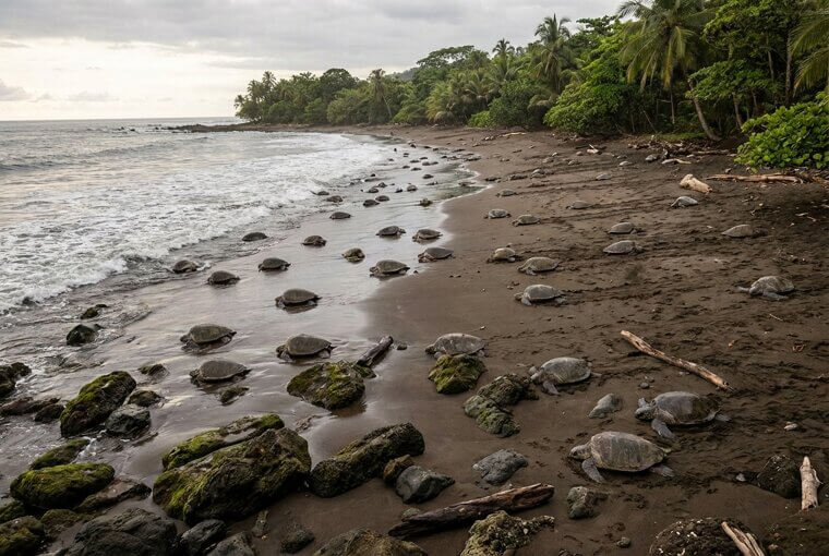
From ground level, you might walk right past them. From 400 feet up, they disappeared entirely into the landscape. Nature has been perfecting camouflage for millions of years — and drones are finally calling its bluff. But hidden wildlife is just the beginning. Beneath ordinary farmland, something even older is waiting to be seen.
Farmland Reveals Ancient Secrets
During a 2018 heat wave in Britain, drone pilots across the countryside started noticing something eerie in their photos. Parched crop fields were developing ghostly geometric patterns — rectangles, circles, straight lines — appearing like watermarks in the golden grain. Those patterns were the outlines of ancient Roman villas, Celtic forts, and roads nobody had walked in two thousand years. The explanation is beautifully simple: buried stone foundations hold less moisture than surrounding soil, so crops above them wither faster during droughts.
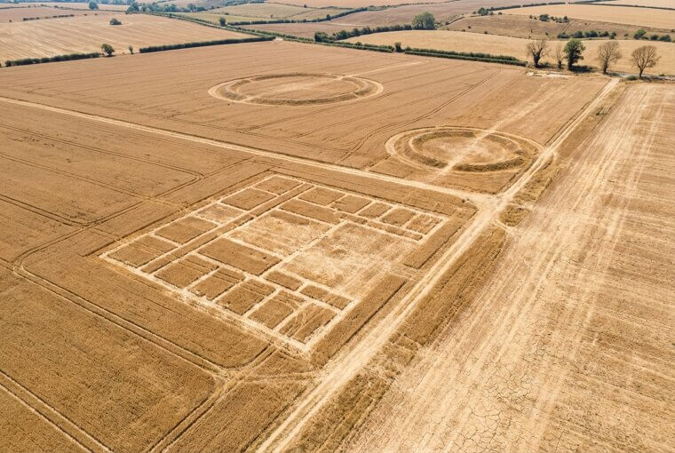
The result is an invisible blueprint that only appears from the sky, under exactly the right conditions. Entire archaeological maps have been rewritten because of hobbyist drone footage. Think about that next time you drive past an ordinary wheat field. But spotting hidden details in aerial photos isn't just luck — there's a technique to it.
How to Spot What's Hidden
Want to see what everyone else misses? Try this three-step method on every aerial photo from here on out. First, scan the edges — not the center. Our eyes naturally fixate on the middle, but the most surprising details lurk in the periphery. Second, look for the pattern breaker. Rows of trees, rooftops, waves — find the one shape that doesn't belong. Your brain will resist noticing it, so force yourself to look systematically.
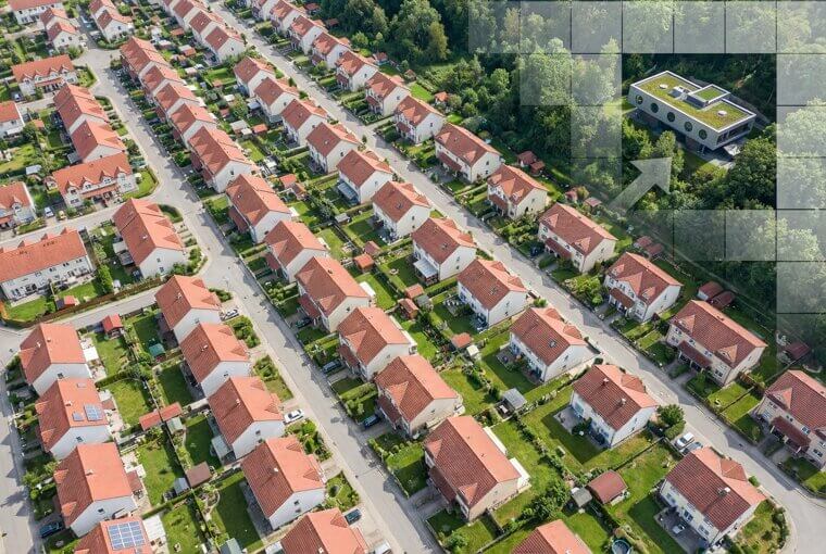
Third — and this one's powerful — study the shadows. Shadows reveal objects that blend into the photo's colors completely. Height, shape, even movement frozen in time. You now have the same scanning instinct that professionals use. And you're about to need it, because the next photo hid something beautiful for thirty years.
The Heart-Shaped Lake No One Knew
A real estate company in Ohio sent a drone over 80 acres of wooded property for a routine listing survey. The photos came back, and there it was — a small, nearly perfect heart-shaped lake nestled deep in the trees. No trail led to it. No road came close. The landowner stared at the image in disbelief. He'd owned that property for thirty years, walked it countless times, and had absolutely no idea it existed.
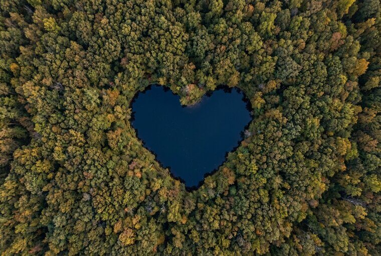
From the ground, it was just dense forest. From above, it was a hidden valentine written by nature itself. Imagine what's sitting on your own property that you've never seen. But not every drone discovery is this charming — some reveal problems you're already living with and don't even know about.
That Roof Damage You Can't See
Right now, there's a good chance your roof is hiding damage you can't detect from your driveway. Insurance adjusters and roofing contractors have gone all-in on drone inspections, and what they're finding is alarming. Cracked shingles that look fine from ground level. Subtle sagging between rafters. Water pooling in shallow depressions you'd never notice without a bird's-eye view. One Colorado roofing company reported that 68% of homes they drone-surveyed had damage the homeowner was completely unaware of — damage averaging $8,000 to repair.
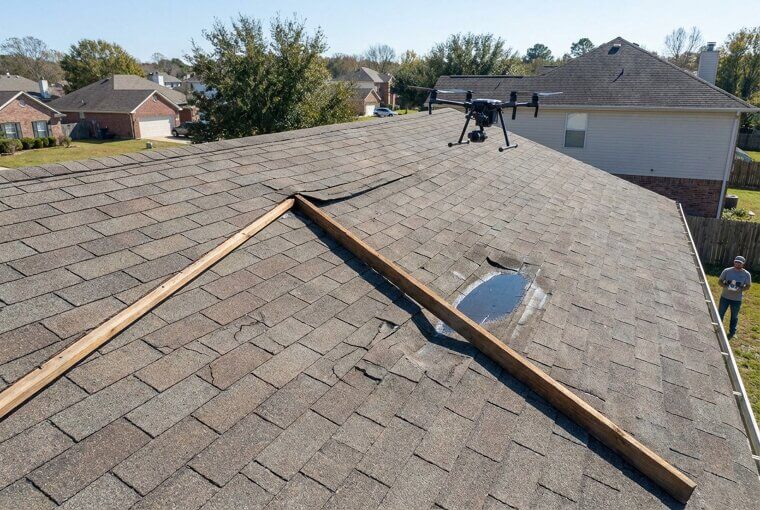
Left unchecked, that hidden deterioration leads to leaks, mold, structural rot, and insurance claims that get denied because the damage was deemed "pre-existing neglect." Your roof is the most expensive surface you own, and you've probably never truly seen it. So what exactly are professional inspectors spotting that the rest of us can't?
Inspectors Prefer Drones Over Ladders
Professional home inspectors are ditching ladders for drones, and the reason goes beyond convenience. A person standing on a ladder sees what's directly in front of them. A drone captures the entire roof plane simultaneously, revealing subtle slope changes that indicate structural settling — something impossible to detect inches from the surface. Inspectors also spot deteriorating flashing hidden behind chimneys and vents, areas a ladder physically can't reach safely.
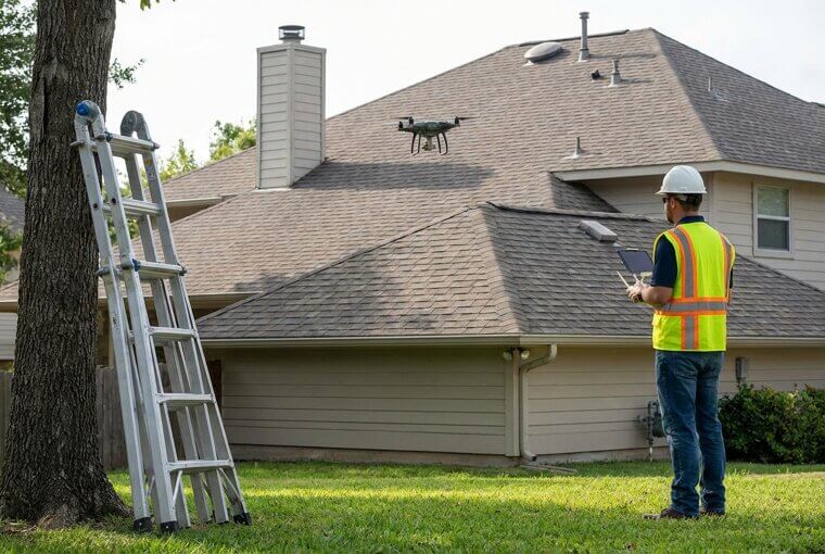
Here's an insider tip worth remembering: during your next home inspection, request the raw drone footage and keep it with a date stamp. That timestamped record becomes invaluable for future insurance claims or resale negotiations. Not every drone revelation involves rooftops, though — one hobbyist pointed his camera at a highway and captured something infuriating.
The Traffic Jam With a Strange Cause
A drone hobbyist in Seattle decided to film a massive highway backup, expecting to find a jackknifed truck or fender bender causing the chaos. Instead, the aerial footage revealed something infuriating: one single car, stopped dead in the middle lane, with the driver visibly hunched over their phone. No accident. No construction. No emergency. Just one person scrolling while hundreds of cars stacked up behind them for over a mile.
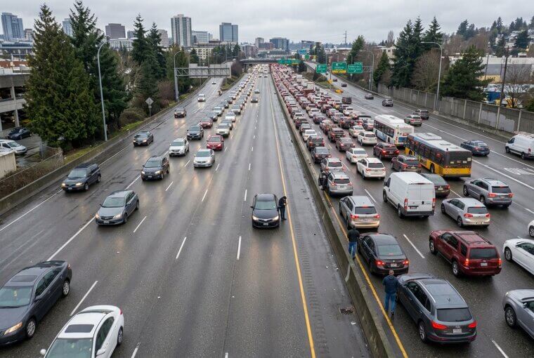
The image went viral as a textbook example of a "phantom traffic jam" — a bottleneck with no physical cause. If you've ever sat fuming in inexplicable gridlock, now you know. But drones don't just expose human absurdity on highways. Point one at a forest canopy, and what's hidden underneath gets genuinely unsettling.
Forests Hide More Than You Think
From above, a dense forest looks like a solid green blanket — completely opaque. That's exactly what makes it such effective cover. When search teams and law enforcement started flying thermal-imaging drones over national forests, they discovered things the canopy had been hiding for months or even years. Hidden homeless encampments with dozens of structures. Illegal marijuana grow operations spanning acres. Lost hikers lying injured just hundreds of feet from trails, invisible to ground searchers who'd walked right past them.
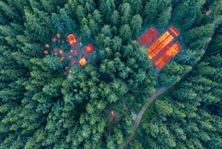
Thermal cameras detect body heat and generator warmth straight through the tree cover, turning that green ceiling into glass. Forests that looked empty were anything but. And not everything found beneath the canopy is so serious — sometimes a drone reveals something unexpectedly hilarious happening much closer to home.
A Dog's Solo Adventure Caught on Camera
You know that guilty look your dog gives when you catch them doing something wrong? Imagine catching them from 400 feet up. A man in rural Tennessee launched his drone to photograph his property and spotted a familiar golden shape trotting confidently three streets away — his dog Max, who was supposedly napping in the backyard. The footage revealed an entire secret routine: Max squeezed through a loose fence board, crossed two yards, visited a porch where someone clearly left him treats, then looped past a neighbor's garden before heading home.
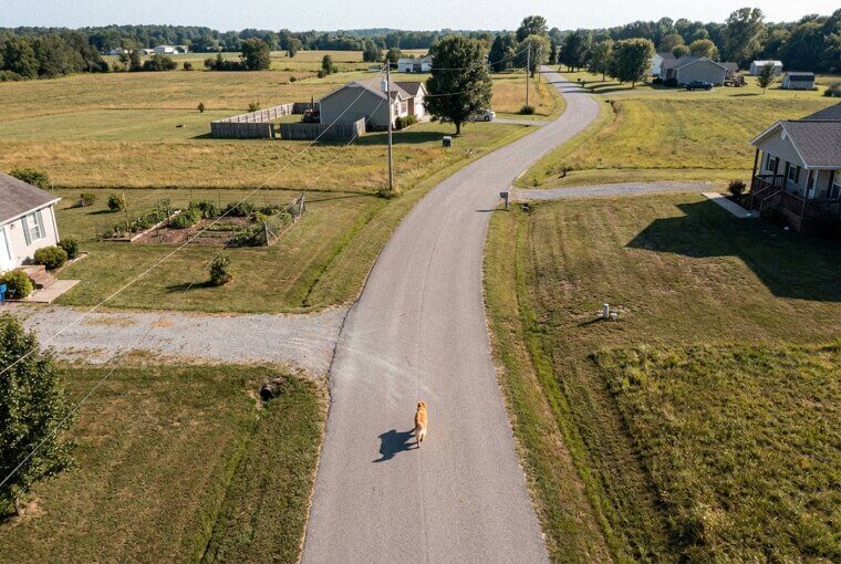
The owner watched the footage laughing and crying at the same time — his supposedly lazy old dog had a whole social life nobody knew about. Sometimes the best discoveries aren't ancient ruins or hidden dangers. They're just proof that the ones we love have their own little worlds. Speaking of worlds you think you know — how confident are you about where your property actually ends?
Your Property Line Might Be Wrong
Here's a number that should make every homeowner uncomfortable: according to land surveyors, roughly 35% of residential fences are built in the wrong location. Drone photography has turned this quiet problem into an explosive one. When aerial images get overlaid with official plat maps, the encroachments become glaringly obvious — a driveway crossing six feet onto a neighbor's lot, a garden shed built entirely on the wrong parcel, fences claiming land that legally belongs to someone else.
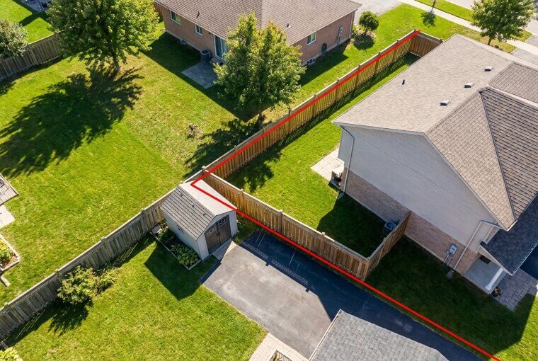
The legal fallout isn't cheap. Boundary disputes average $8,000 to $15,000 in legal fees, and some escalate into lawsuits that drag on for years. Worse, if a neighbor has openly used your land long enough, they may claim legal ownership through adverse possession. The good news? There's a simple way to check your own boundaries before trouble starts.
Check Your Fence From Above
Here's something you can do this weekend. If you or anyone you know owns a drone, fly it slowly along your property boundaries and take clear overhead photos. Then visit your county assessor's website — most offer free downloadable plat maps showing exact legal boundaries. Compare the two side by side. Misaligned fences and encroaching structures will jump right out.
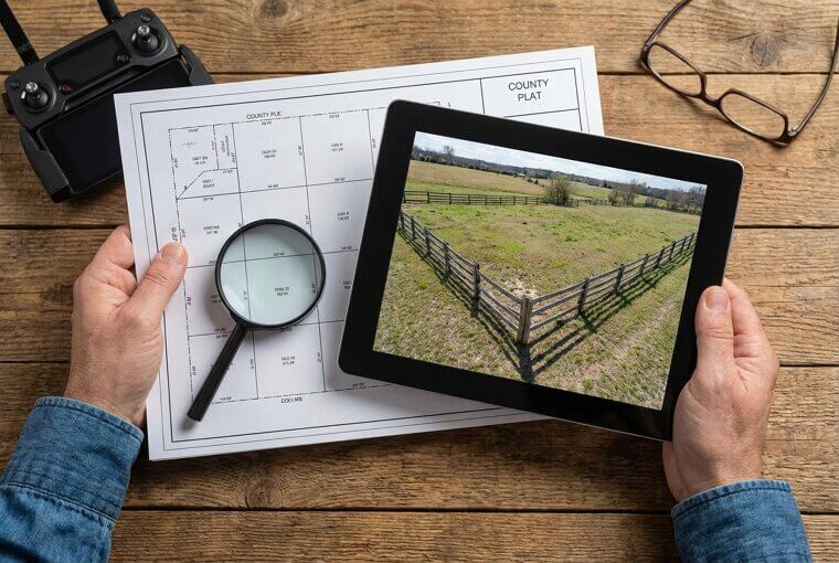
Don't have a drone? Open Google Earth on your phone right now and zoom into your property. The satellite view is surprisingly detailed, and obvious problems — like a neighbor's shed sitting past the boundary line — are easy to spot. A ten-minute check could save you thousands. Of course, not every drone surprise involves property lines. Sometimes it involves a vineyard, a wedding party, and one very sleepy groomsman.
The Wedding Photo Everyone Gasped At
The couple wanted one perfect overhead shot of their vineyard wedding — everyone gathered, golden light, rows of grapevines stretching to the hills. From ground level, it looked flawless. Then the drone photo arrived. There in stunning detail was a groomsman in the back row, head tilted back, completely asleep. Next to him, another groomsman was mid-pour, sneaking wine directly from a bottle he'd swiped off a table. And in the bottom corner, two flower girls were locked in a full wrestling match, one clearly winning.

The couple posted it immediately. It became their favorite photo from the entire day — because it was actually real. The thing hiding in plain sight isn't always mysterious. Sometimes it's just wonderfully, hilariously human. But not every hidden truth caught by drones makes people laugh. Some make people furious.
Pollution You're Not Supposed to See
In 2020, a hobbyist flying his drone over a river in North Carolina captured something chilling: bright green liquid pouring from an unmarked pipe directly into the waterway. The photo went viral within hours. Within weeks, the EPA launched a formal investigation that resulted in a six-figure fine against a meatpacking plant. That photographer had no training, no agenda — just a camera in the sky and a willingness to share what he saw.
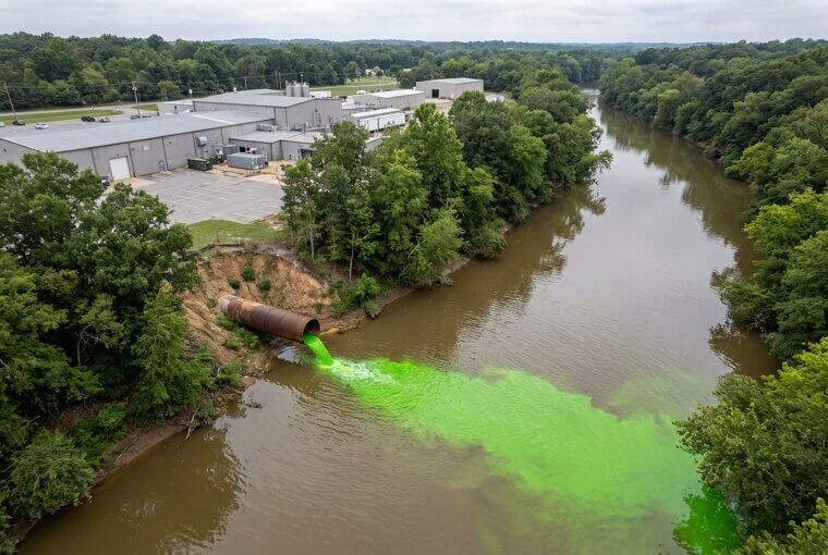
This isn't an isolated case. Citizen drone footage has exposed illegal chemical dumping in Texas, coal ash contamination in Tennessee, and factory runoff poisoning farmland across the Midwest. If you live near a river, creek, or industrial zone, the water your community depends on may be carrying secrets only a drone can reveal. One hobbyist's single photograph changed an entire town's future.
One Photo Changed an Entire Town
In 2019, a retired engineer in rural Ohio flew his drone over a creek behind his property and photographed an unmistakable orange-brown plume flowing from a drainage culvert near a metal finishing plant. He sent the image to a local newspaper reporter — who recognized its value immediately. The story ran with the photo front and center. Within two months, the state environmental agency confirmed elevated levels of hexavalent chromium, fined the facility $187,000, and mandated quarterly water testing that continues today.
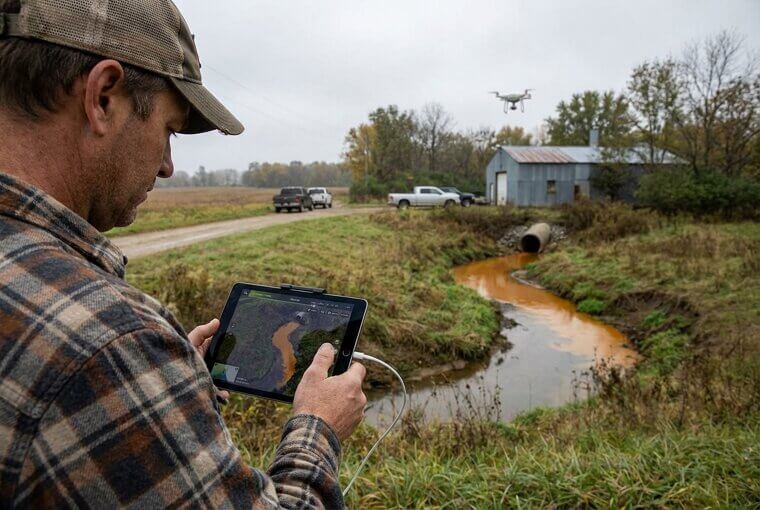
Here's what insiders know: local journalists are actively building relationships with drone-owning citizens. News desks call them "eyes in the sky" tipsters. One camera, one flight, one photo — and a town got clean water monitoring it never had before. That same principle of trained observation is exactly what search and rescue teams depend on every day.
What Search and Rescue Teams See
Search and rescue teams don't just fly drones over wilderness and hope something jumps out. They work systematically, dividing terrain into grid squares and reviewing footage frame by frame — sometimes at quarter speed. Their trained eyes hunt for specific anomalies: a flash of unnatural color against brown earth, a footprint trail visible only in morning dew, broken branches forming a directional line through dense forest. Remember section three's point about training your eye? These professionals have turned that skill into a science.
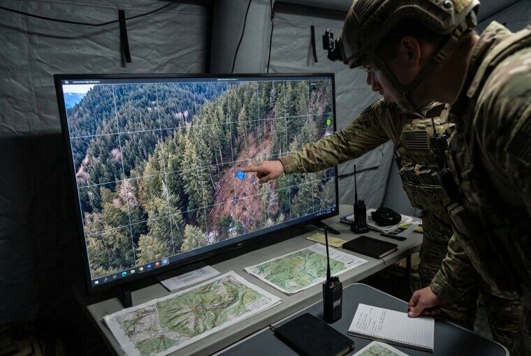
What separates them from casual viewers is patience. They'll study a single frame for thirty seconds while most of us would scroll past in two. That discipline has pulled hikers from ravines and found lost children before nightfall. In one remarkable case, it wasn't a person that gave away the location — it was a shadow.
The Hiker Found by a Shadow
The drone operator scanning that wilderness grid wasn't looking for a person anymore — he was looking for anything that didn't belong. What caught his eye was a shadow. Among dozens of tree shadows stretching uniformly east, one shadow was wrong. Too short, too wide, cast at a slight angle from behind a boulder. It wasn't a tree. It was the missing hiker, lying injured and invisible from every other angle.
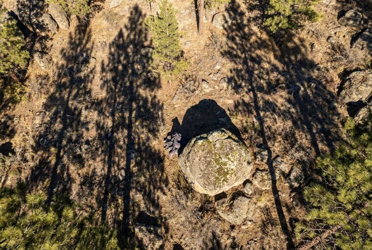
Remember the tip from section six about studying shadows in aerial photos? This is that principle saving a life. The hiker's clothing blended perfectly with the rocky terrain, but shadows can't hide. Once you understand why shadows reveal what colors conceal, you'll never look at an aerial photo the same way again.
Shadows Tell the Whole Story
Here's a skill that makes you think like a professional photo analyst. Next time you see any aerial or satellite image, look at the shadows first. Three things to check: shadow direction tells you the time of day the photo was taken — shadows point west in the morning, east in the afternoon. Shadow length reveals an object's height — long shadow means tall structure, short shadow means low to the ground.
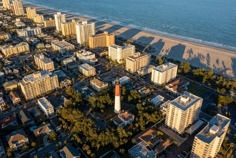
And here's the one most people miss: shadow gaps. When two buildings appear to touch from above, a thin line of shadow between them reveals hidden space — an alley, a walkway, or something someone tucked out of sight. Try this technique right now on Google Earth. You might be surprised what your neighbor's yard reveals.
The Neighbor's Yard Isn't What It Seems
Here's something real estate agents didn't plan on: drone photos meant to showcase a home for sale have accidentally exposed what the neighbors are hiding. Those six-foot privacy fences? Completely useless from 200 feet up. One viral listing photo revealed the seller's gorgeous landscaped property right next to a backyard that looked like a small-scale junkyard — rusted car parts, tarps, and what appeared to be three broken trampolines stacked on each other.
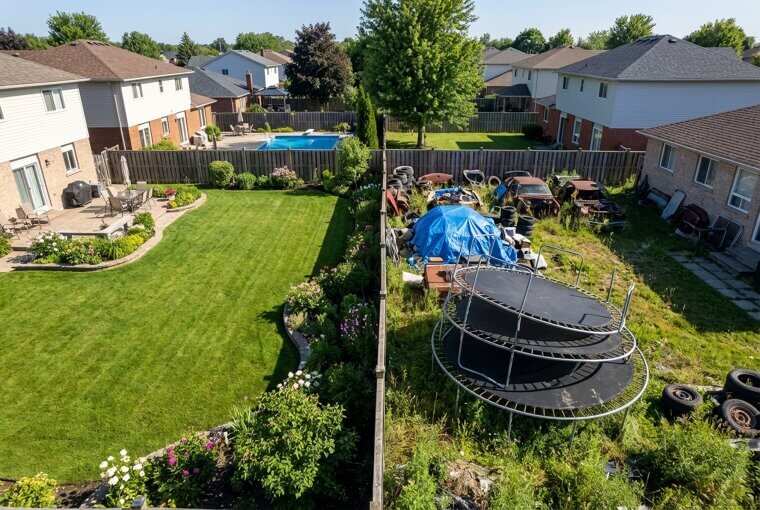
Other listing photos have inadvertently documented unpermitted additions, above-ground pools violating setback codes, and one memorable case where a neighbor was clearly running a backyard auto shop. Have you ever wondered what your yard looks like from above? Turns out, some hidden things aren't buried underground — they're buried in history.
Archaeologists' Favorite New Tool
Remember those ghostly crop patterns revealing ancient ruins from section five? Professional archaeologists have fully embraced what hobbyists stumbled onto. Consumer drones equipped with LiDAR — laser scanning that penetrates dense vegetation — have uncovered entire lost cities beneath Guatemalan jungle canopy, rewriting Mayan population estimates overnight. In Cambodia, similar flights revealed medieval urban networks surrounding Angkor Wat that dwarfed previous maps. A decade ago, these surveys required chartered aircraft, specialized crews, and budgets exceeding a million dollars.
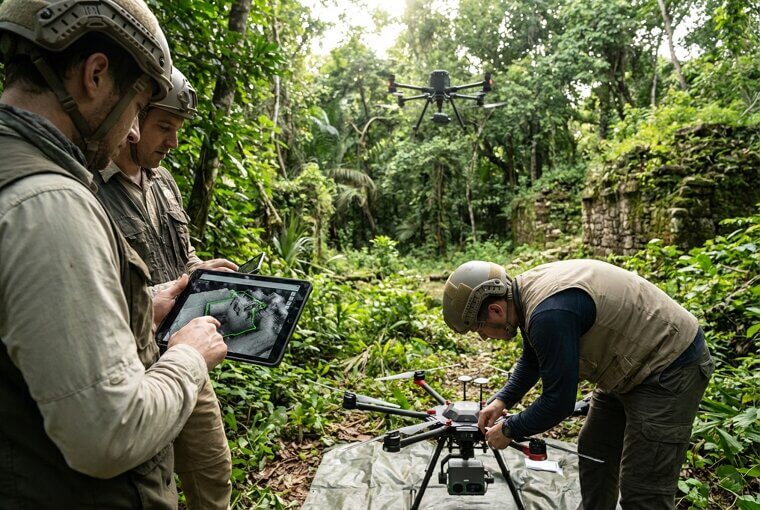
Today, a LiDAR-equipped drone costs roughly what a used car does. Retired teachers and amateur historians are conducting legitimate archaeological surveys from their trucks. The professionals aren't threatened — they're thrilled, because thousands more eyes scanning the earth means thousands more discoveries. And you don't need LiDAR or a jungle to find hidden history beneath your feet.
Your Town Has Hidden History Too
Here's something you can do in the next five minutes. Open your browser and search your town or county name plus "aerial archaeology." You might find researchers have already documented forgotten structures right beneath your streets. For deeper exploration, visit the USGS Earth Explorer — it's completely free — and pull up historic aerial photos of your area dating back decades. Compare old images to current ones. That empty lot downtown? It might show the footprint of a building demolished before you were born.
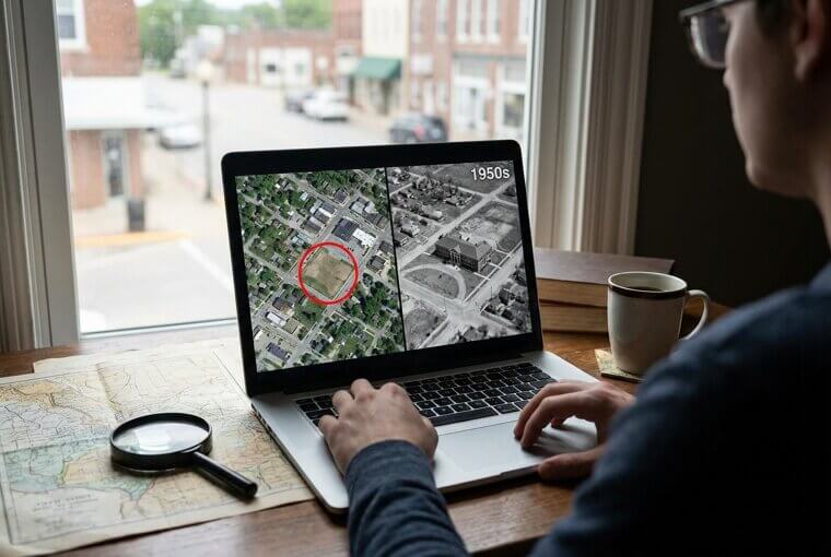
Old riverbeds, Native American earthworks, colonial-era road networks — they're all hiding in plain sight from above, waiting for someone curious enough to look. The ground you walk every day holds stories no one alive remembers. But sometimes those hidden stories aren't ancient at all — sometimes they're unsettlingly recent.
The Swimming Hole With an Underwater Car
A drone photographer shooting a crystal-clear quarry on a summer afternoon captured a stunning turquoise image — and something deeply unsettling. There, resting on the bottom in about fifteen feet of water, sat the unmistakable outline of a full-sized sedan. Swimmers had been floating directly above it for years. The car's shape was perfectly visible from the air, yet completely invisible to anyone treading water at the surface. The photo went viral, and local authorities recovered the vehicle.
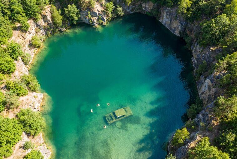
It wasn't an isolated case. Across the country, drone operators have spotted submerged cars in lakes, ponds, and reservoirs — and in several chilling instances, those vehicles were linked directly to missing persons cases that had gone cold for decades.
Cold Cases Cracked From the Sky
In 2019, a retired investigator named Barry Fay spotted something in Google Earth satellite imagery of a Palm Beach County retention pond — a submerged car that had been sitting there for twenty-two years. Inside were the remains of William Moldt, a man reported missing in 1997. His family had waited over two decades for answers. That single aerial image closed the case. Since then, volunteer groups like Adventures With Purpose have used drones and sonar to locate over twenty submerged vehicles connected to missing persons.
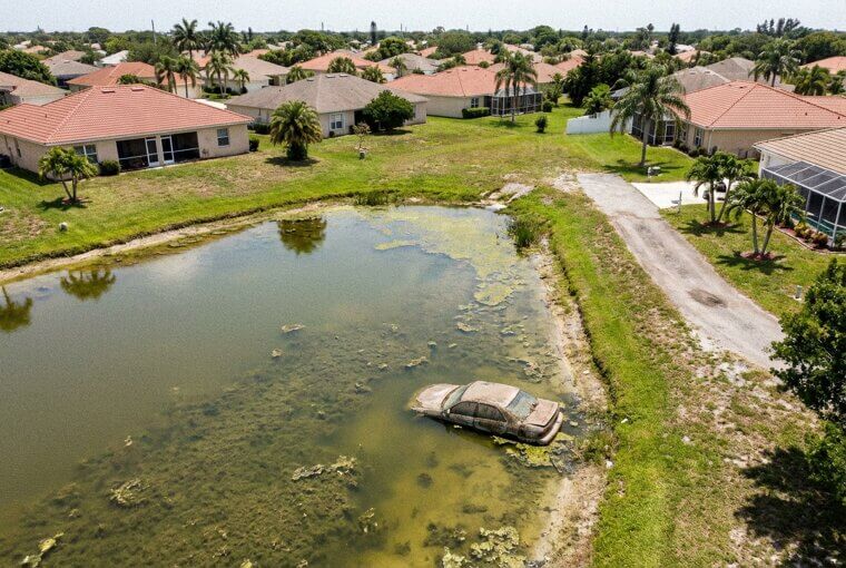
Disturbed soil patterns visible only from above have also led investigators to clandestine graves. These aren't hypothetical scenarios — they're active law enforcement techniques changing how cold cases are approached nationwide. What makes this truly remarkable is who's driving many of these discoveries.
Everyday People Are Making Discoveries
Here's what's extraordinary about nearly every story in this article — the people behind these discoveries aren't scientists, detectives, or professional photographers. They're people like you. A seventy-year-old grandmother in Wales flew a small drone over her sheep pasture and noticed strange rectangular patterns in the grass. Archaeologists confirmed it was a previously unknown Roman fort. A retired firefighter in Oregon launched his drone over a river on a hunch and spotted a missing kayaker clinging to a rock, invisible from the shoreline.
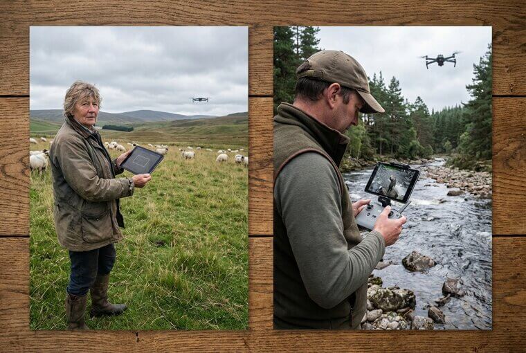
Parents, retirees, hobbyists tinkering on weekends — they're rewriting history books and saving lives because they looked at familiar ground from an unfamiliar angle. You don't need credentials. You just need curiosity and a willingness to look closer. And here's the thing — you might not even need a drone.
You Don't Even Need a Drone
Here's something you can try right now. Open Google Earth on your phone — it's free. Type in your home address and zoom in. Switch to satellite view if it isn't already. Now look carefully at your property. You'll see your roof, your yard, your driveway from a perspective you've probably never experienced. Notice any odd color patches in the grass? Strange shadows you can't explain? Patterns you never knew existed? Pinch to zoom closer. Drag to explore your street, your old school, that lake you visited last summer.

Apple Maps satellite view works beautifully too, and USGS Earth Explorer offers historical aerial imagery going back decades — completely free. You're now your own aerial detective. But what exactly should you be looking for in your own yard?
What to Look for in Your Own Yard
Here's your personal checklist. First, look for unusual color patches in your lawn — darker green rectangles or circles often mark buried foundations, old septic tanks, or debris that holds moisture differently than surrounding soil. Second, scan for straight-line depressions or raised strips you never noticed from ground level. These frequently trace old walkways, drainage pipes, or filled-in trenches. Third, study your trees. Trees cluster around forgotten water sources — old wells, broken pipes, buried streams. A tight group of trees in an otherwise open yard is almost always telling you something.
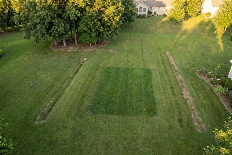
Compare what you see in satellite view to your oldest property records. Many county assessor websites include historical plat maps that reveal structures long since demolished. What you find might just be an old shed foundation — or it might be the emotional centerpiece of someone's entire life story.
The Photo That Changed How He Saw Home
Before his childhood home sold, a man named David flew a borrowed drone over the backyard one last time. What he saw stopped him cold. There in the grass was a perfect worn loop — a walking path his late father had traced every evening for forty years. Rain or shine, after dinner, his dad walked that same quiet circle. From the ground, you'd never see it. The grass just looked uneven. But from above, it was unmistakable — a portrait of a man's entire routine, pressed into the earth by decades of faithful footsteps.
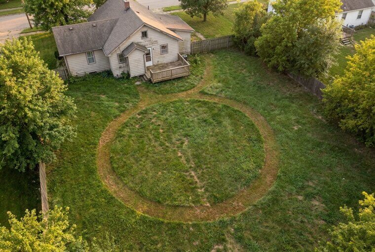
David said he sat in his car and cried for twenty minutes. That photo became the most important thing he took from the house — not furniture, not keepsakes. A picture of a path worn by love. Sometimes the most extraordinary thing hiding in plain sight is simply a life well lived.
Everything Looks Different From Above
That worn path in David's backyard was always there. The alligator was always in that pool. The Roman fort was always beneath that pasture. Nothing changed except the angle. That's the real story here — not drones, not technology, but the quiet truth that the world is richer than we see on any given day. Hidden histories sit beneath our feet. Small wonders hide behind every fence. The people we love leave marks we can only find when we're willing to look differently.
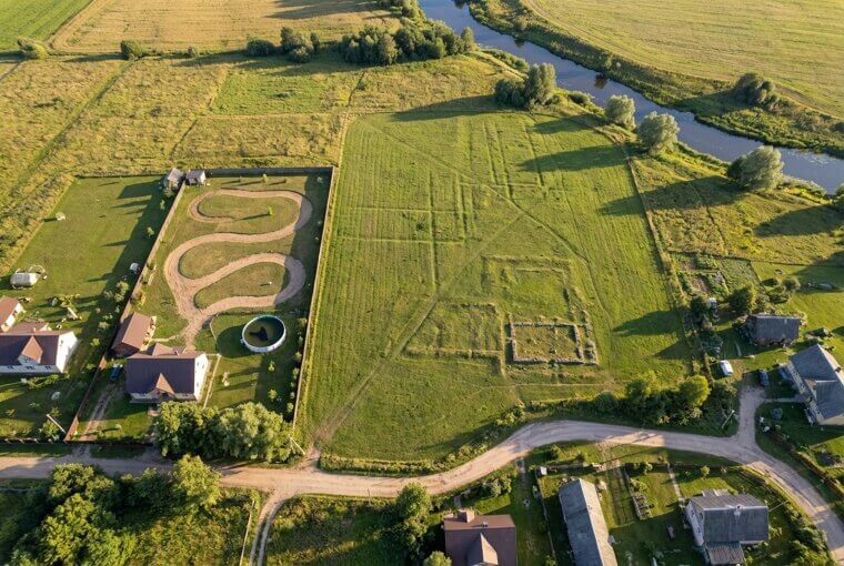
You don't need a drone to carry that lesson forward. You just need curiosity and the willingness to pause. If this article made you see your own backyard, your own town, your own memories a little differently — share it with someone who'd love that feeling too. The world is full of things hiding in plain sight. Now you know how to find them.Disclaimer: This story is based on real events. However, some names, identifying details, timelines, and circumstances have been adjusted to protect the privacy of the individuals involved. The images in this article were created with AI and are illustrative only. They may include altered or fictionalized visual details for privacy and storytelling purposes